


Tú hevur ongar yndis enn
Her kanst tú savna íblástur, greinar, tiltøk og støð, sum tú hevur áhuga fyri.
Trýst á ikonið á síðurnar, so koma tær fram her.
Tínir yndis
Íblástur & Greinir
Tiltøk & Túrar
Støð
Bygdagøtur
INSPIRATIÓNIR & ARTIKLAR
TILTØK & GONGUTÚRAR
Støð
Akrar - Víkarbyrgi


Link Copied!

-
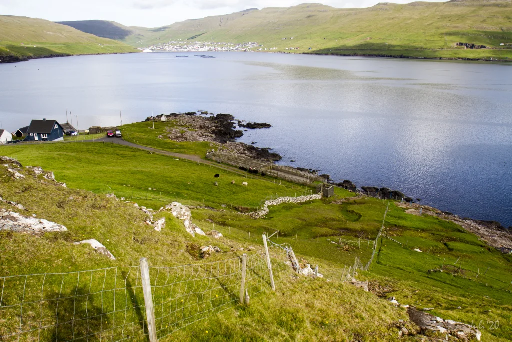 View above Akrar with Vágur in the background. The villagepath starts outside the sheepfold going straight up along the fence up on the first crog. In the Background Vágur. Photo: Óli Gardshodn
 -
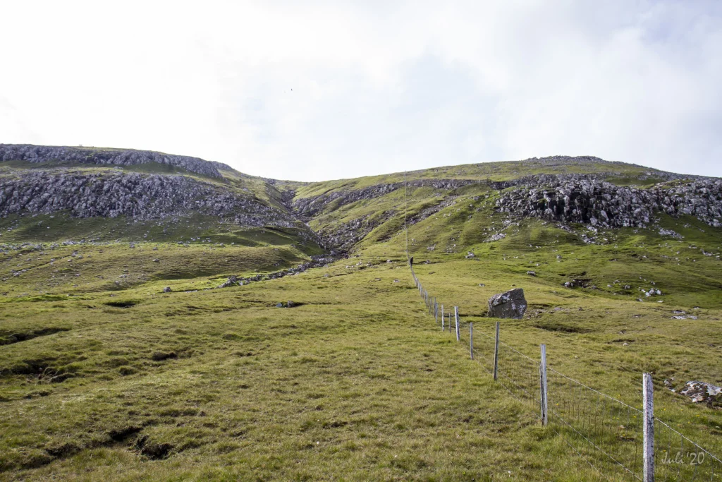 Up on the first crag, go straight up along the path on the east side of the gorge. Photo: Óli Gardshodn
 -
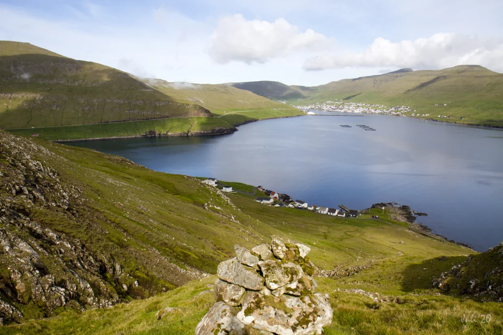 View above Akrar. In the background Vágur. Photo: Óli Gardshodn
 -
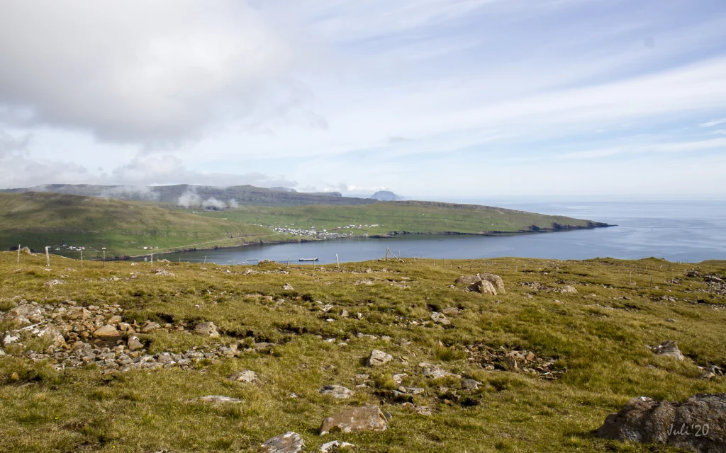 View up on the top at 249m. The village Porkeri in the background. Photo: Óli Gardshodn
 -
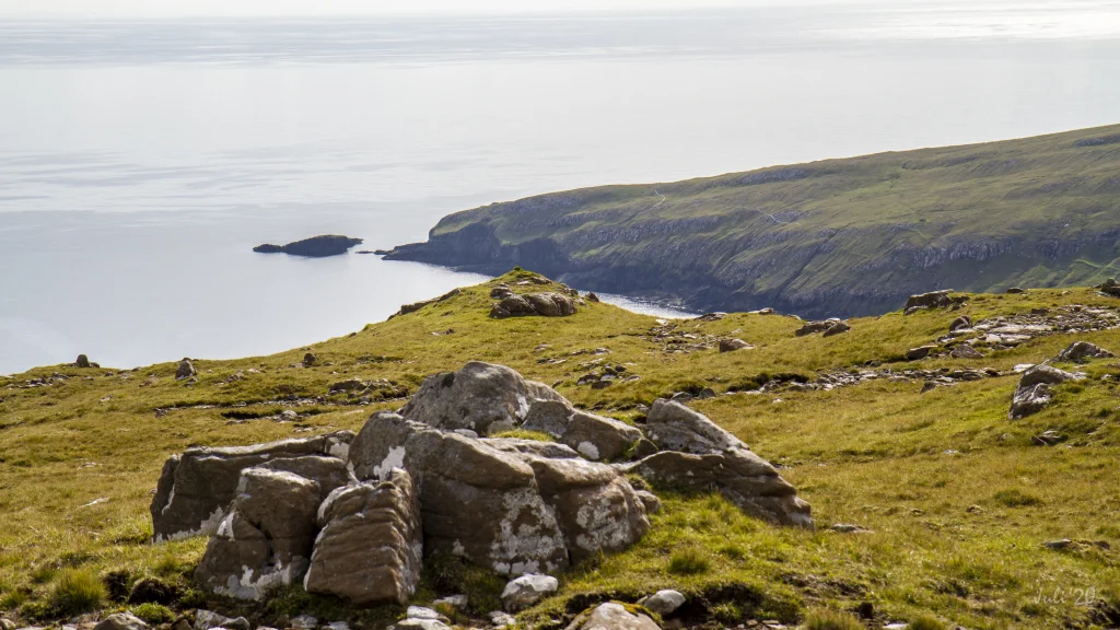 The view on the top at 249m. Baglhólmur - the small islet to the left in the background. Here the landscape layers clearly show that Faroe Islands incline down eastwards. Photo: Óli Gardshodn
 -
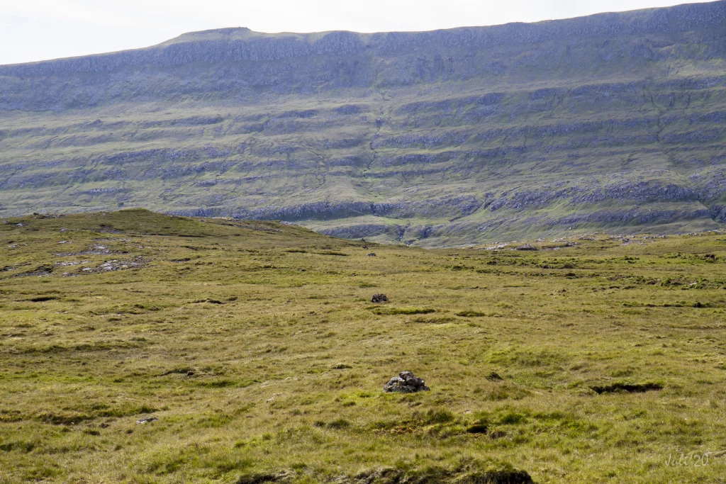 The cains although not so large clearly show the path between Akrar and Víkarbyrgi. Photo: Óli Gardshodn
 -
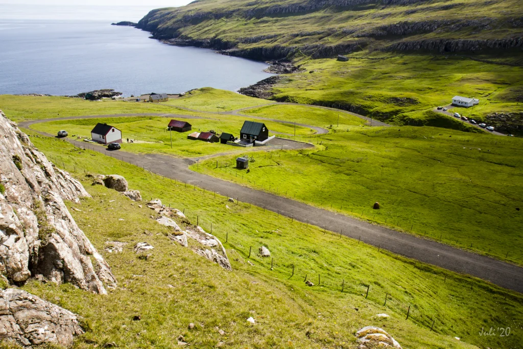 View above Víkarbyrgi. Photo: Óli Gardshodn


-
View above Akrar with Vágur in the background. The villagepath starts outside the sheepfold going straight up along the fence up on the first crog. In the Background Vágur. Photo: Óli Gardshodn
-
Up on the first crag, go straight up along the path on the east side of the gorge. Photo: Óli Gardshodn
-
View above Akrar. In the background Vágur. Photo: Óli Gardshodn
-
View up on the top at 249m. The village Porkeri in the background. Photo: Óli Gardshodn
-
The view on the top at 249m. Baglhólmur - the small islet to the left in the background. Here the landscape layers clearly show that Faroe Islands incline down eastwards. Photo: Óli Gardshodn
-
The cains although not so large clearly show the path between Akrar and Víkarbyrgi. Photo: Óli Gardshodn
-
View above Víkarbyrgi. Photo: Óli Gardshodn
Ein stuttur og lættur túrur tvørtur eftir tí vallaða Akravegnum, við vøkrum útsýni yvir Vágs- og Víkarfjørð, har landslagið er rættiliga merkt av, at fláirnar hella so nógv eystureftir
Í Økrum finnur tú bygdagøtuna við at ganga út gjøgnum rættina uttast í bygdini. Komin út um rættina er neyðugt at fara upp um okkurt hegn og so ganga beint niðan vinstrumegin (eystan fyri) hegnið.
Tá ið tú kemur niðan á fyrstu høvdina, gongur tú beint niðaneftir fram við Ærgisá, eystarumegin gilið. Haðani eru varðar allan vegin, heilt oman í Víkarbyrgi.
Uppi á Brunni er gott útsýnið, og har er hugnaligt at sita og njóta løtuna við útsýninum norð á Porkerisnes og eystur á Baglhólm, har tað so týðiliga sæst, hvussu landslagið er sokkið niður eystureftir.
Komin oman í Víkarbyrgi ber til at ganga yvir á høvuðsvegin heldur enn at fylgja gøtuni heilt oman í bygdina. Á henda hátt slepst undan at klúgva upp um hegnið, ið gongur tvørtur um bygdagøtuna longri niðri við bygdina.
Møguligt er at ganga túrin úr báðum endum. Tað er eitt sindur brattari at ganga niðan úr Økrum


Akrar - Víkarbyrgi
Public transport
There is no public transportation to either Akrar or Víkarbyrgi.
Arriving by car
Parking, Akrar
Parking for three cars is available by the sheep pen at the end of the village (see the area marked with green in the picture). From there, go through the gate in the sheep pen to reach the village path (the blue line).
-
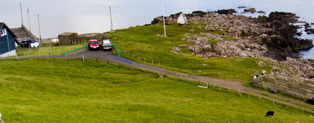 See green line for parking and blue line for strating point
 -
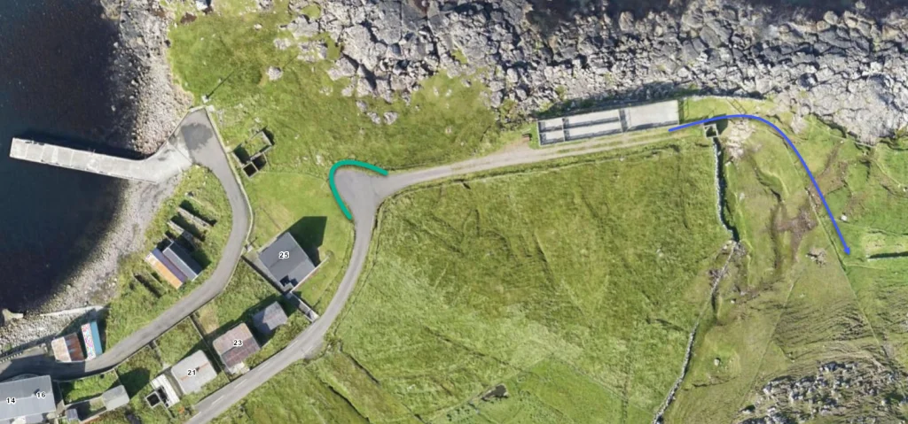 See green line for parking and blue line for strating point
 -
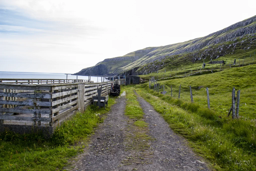 Starting point, Akrar


Víkarbyrgi - Akrar
Public Transport
There is no public transportation to either Akrar or Víkarbyrgi.
Arriving by car
Parking, Víkarbyrgi
Good parking is found on the main road. You can park your car by the second last bend in the road before you reach the village (the area marked with green). From here, hike up along the river and through the gully by the boulder Steinurin Grái (marked with blue).
-
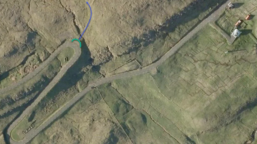
-
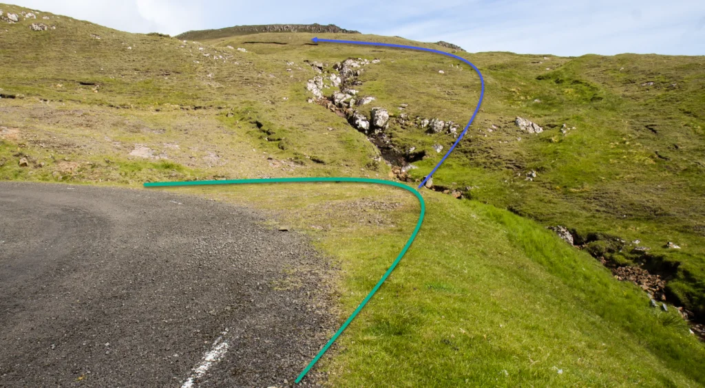 See green line for parking and blue line for strating point


Akrar - Víkarbyrgi
Víkarbyrgi - Akrar
Fakta

Tíð

longd

Hægsta stað

Hæddarmetrar
 Suitable for children for children over the age of 6. The hike is for the most part child-friendly. However, the stretch up through the ravine at Akrar is somewhat steep. Here children must be accompanied
 Medium
- It is only the hike up through the ravine at Akrar that is somewhat steep
Medium
- It is only the hike up through the ravine at Akrar that is somewhat steep
 Even and good for walking throughout, except for the stretch up through the ravine from Akrar, which is quite steep. Minor screes and some loose ground are found on the path through the ravine

Øki / Torleikastig

 Avbjóðandi
 42 km /
16t
42 km /
16t

 6 km /
2t
6 km /
2t

 5 km /
1t
30m
5 km /
1t
30m


