


Tú hevur ongar yndis enn
Her kanst tú savna íblástur, greinar, tiltøk og støð, sum tú hevur áhuga fyri.
Trýst á ikonið á síðurnar, so koma tær fram her.
Tínir yndis
Íblástur & Greinir
Tiltøk & Túrar
Støð
Bygdagøtur
INSPIRATIÓNIR & ARTIKLAR
TILTØK & GONGUTÚRAR
Støð
Tórshavn - Kirkjubøur


Link Copied!

-
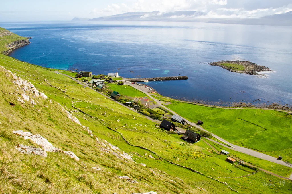 View over the ancient village of Kirkjubø. Photo: Óli Gardshodn
 -
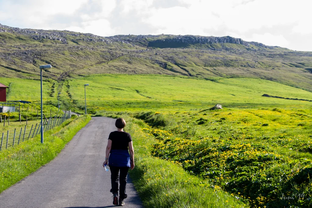 The village path is clearly visible all the way up to the first cain that you see in the centre at the top. Photo: Óli Gardshodn
 -
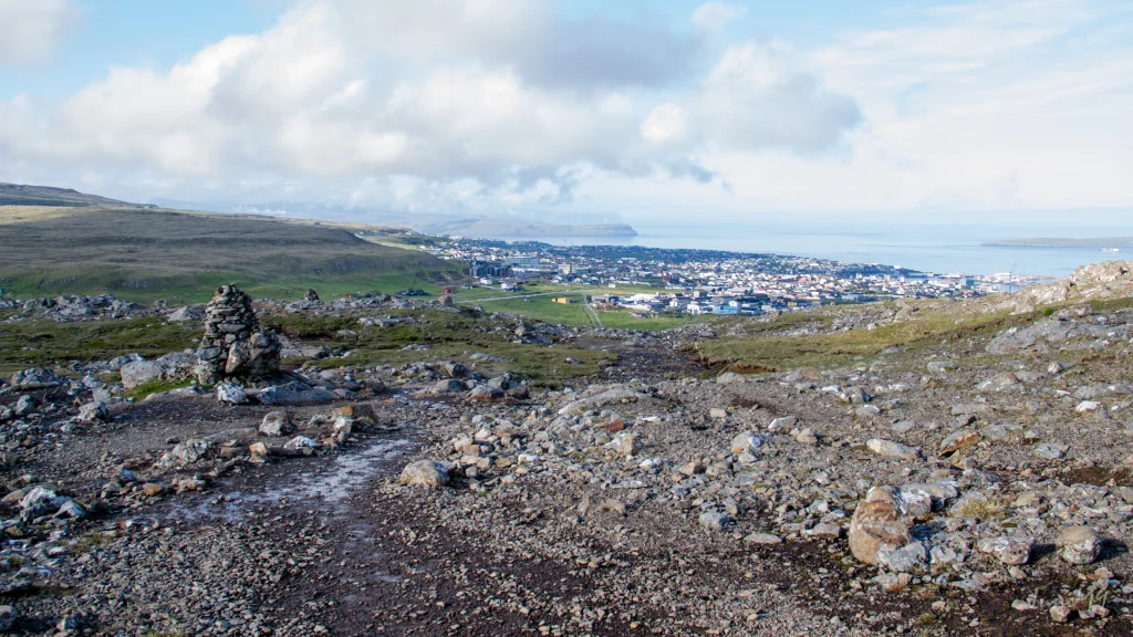 Up from the first cain in 190m, you have a beautiful view over Tórshavn with the island of Eysturoy and the northern islands in the background. Photo: Óli Gardshodn
 -
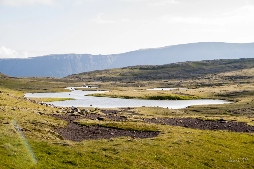 Up on the plain, everything is beautiful and peaceful while the birds gather on the water. Photo: Óli Gardshodn.
 -
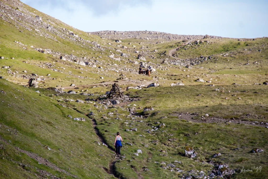 The cosy stroll over to the old gathering place, Reynsmúlalág, where the great speeches were held from the stone pulpit and the folk songs sung by the audience up on the grassy slope. Here it is only the imagination that sets the limits... Photo: Óli Gardshodn
 -
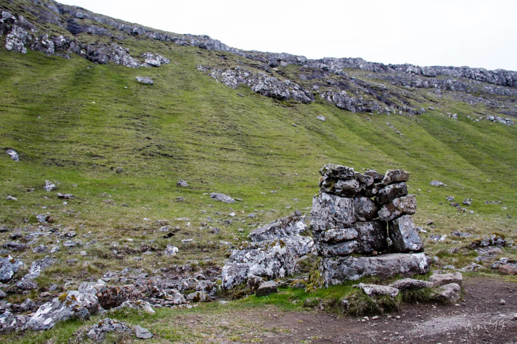 The rostrum at Reynsmúlalág, built of stones, used in those days when folk meetings were held in open air from the 19th century up to the 1960s.
 -
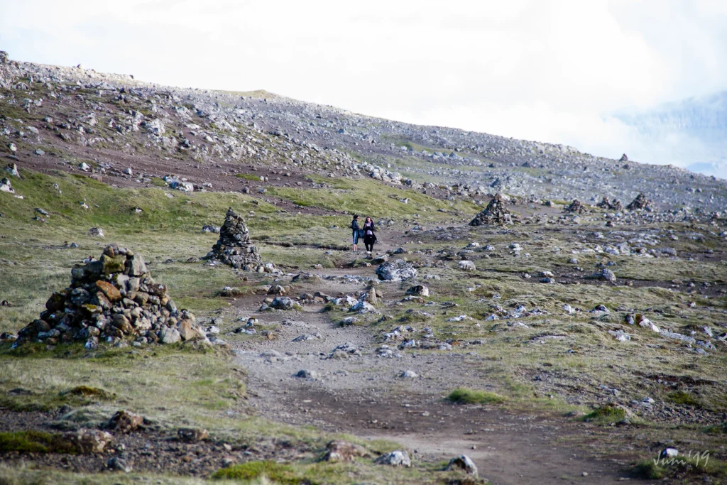 The cairns stand close along the path. Photo: Óli Gardshodn
 -
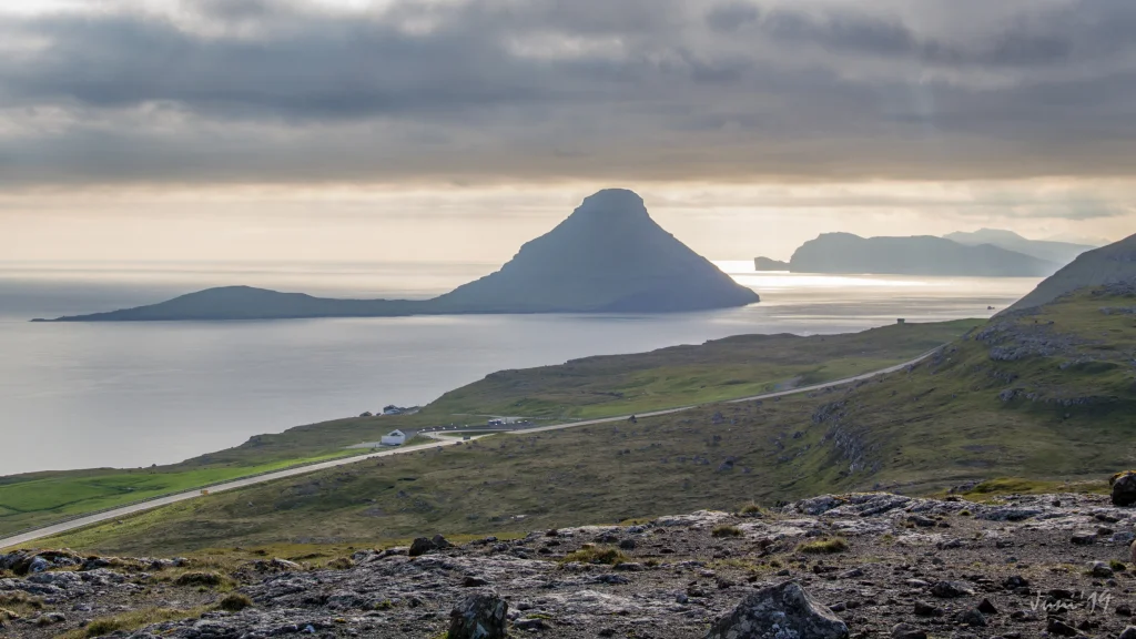 Along the path there is a good view of the beautiful island of Koltur. In the background is the island of Vágar Photo: Óli Gardshodn
 -
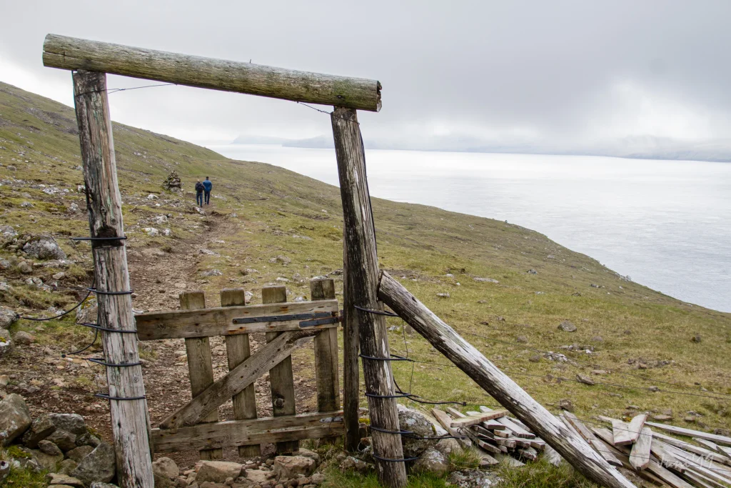 Gate between parts of the outfield in Kirkjubø. Photo: Óli Gardshodn
 -
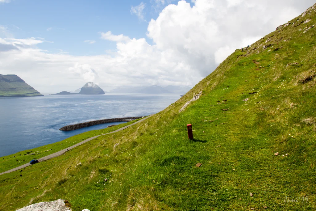 The path up from Kirkjubø. Photo: Óli Gardshodn
 -
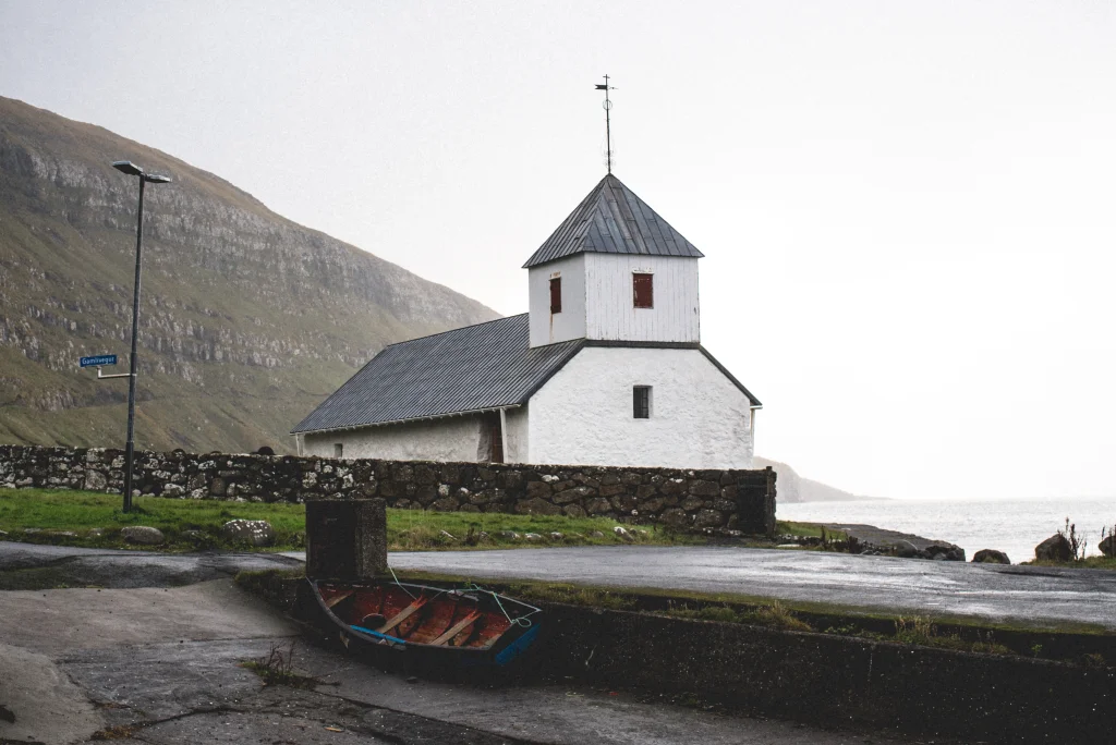 Kirkjubøur Church is the oldest church in the Faroe Islands still in use. It was built in the 13th century. Photo: Abdellah Ihadian


-
View over the ancient village of Kirkjubø. Photo: Óli Gardshodn
-
The village path is clearly visible all the way up to the first cain that you see in the centre at the top. Photo: Óli Gardshodn
-
Up from the first cain in 190m, you have a beautiful view over Tórshavn with the island of Eysturoy and the northern islands in the background. Photo: Óli Gardshodn
-
Up on the plain, everything is beautiful and peaceful while the birds gather on the water. Photo: Óli Gardshodn.
-
The cosy stroll over to the old gathering place, Reynsmúlalág, where the great speeches were held from the stone pulpit and the folk songs sung by the audience up on the grassy slope. Here it is only the imagination that sets the limits... Photo: Óli Gardshodn
-
The rostrum at Reynsmúlalág, built of stones, used in those days when folk meetings were held in open air from the 19th century up to the 1960s.
-
The cairns stand close along the path. Photo: Óli Gardshodn
-
Along the path there is a good view of the beautiful island of Koltur. In the background is the island of Vágar Photo: Óli Gardshodn
-
Gate between parts of the outfield in Kirkjubø. Photo: Óli Gardshodn
-
The path up from Kirkjubø. Photo: Óli Gardshodn
-
Kirkjubøur Church is the oldest church in the Faroe Islands still in use. It was built in the 13th century. Photo: Abdellah Ihadian
Serstøk er Reynsmúlalág og góða útsýnið vestureftir móti Hesti og Koltri
Túrurin byrjar á krossinum, har Landavegur og Velbastaðvegur skarast. Haðan fylgir tú gøtuni oman til Sandá og bóndagarðin, har gøtan til Kirkjubøar byrjar. Far haðan niðan í brekkuna. Tá ið tú ert komin niðaná, vend tær so á og hygg oman yvir Havnina og út á Nólsoynna. Tá ið tú heldur fram, gakk um hamarsskortin Reynsmúla til Reynsmúlalág. Her eru tvey vøtn, har rytur eru um summarið. Gakk eftir varðunum, og tú sært á ein bergklett. Kletturin varð brúktur til uttandura fólkafundir frá 19. øld og upp í 1960-árini. Á hesum fundum vórðu røður hildnar, fosturlandssangir (skrivaðir til høvið) vórðu sungnir, og flaggað varð við Merkinum. Tað er lætt at ímynda sær, hvussu mannamúgvur hava sitið í brekkunum framman fyri hetta hásætið og lurtað eftir fólkum sum Jóannesi Patursson (1866-1946), undangongumanninum í føroysku tjóðskaparrørsluni. Siðvenjan við fólkafundum er framvegis livandi ikki minst í Havn ólavsøkudag. Eftir Reynsmúlalág gongur gøtan suðureftir. Meðan gingið verður, njót stórbæra útsýnið yvir Sandoy, Hest, Koltur og Vágar. Sambært søgn helt ein ungur maður í Koltri, nevndur Magnus, saman við eini gentu úr Hesti. Pápi gentuna visti einki um hetta sambandið. Tá ið tað rak suður, svam Magnus frá Koltri yvir í Hest at eiga eina løtu saman við gentu síni, og tá ið rákið skifti, svam hann aftur til Kolturs. Pápi gentuna varnaðist hesar ástarfundir. Og ein dagin, Magnus kemur upp á land, stendur faðir gentuna fyri honum við øks í hendi og hóttir við at drepa hann. Magnus varð tvingaður útí aftur og varð ongantíð sæddur aftur. Rákið tók hann við sær til havs. Søgnin sigur, at í hevnisøku tók íðan, sum verður nevnd Grísarnir, seg upp stutt eftir tað í Koltursundi, og har leikar hon í tann dag í dag. Tá ið tú nærkast Kirkjubø, sæst Kirkjubøhólmur, sum var fastur í oynni og bygdini. Toftirnar eftir gomul hús síggjast framvegis á hólminum. Haðan gongur gøtan oman í bygdina og endar við eitt liða einar 50 metrar úr næstu húsum.Kirkjubøur er vøkur og hugnalig bygd, og flestu húsini eru bygd í gomlum sniði. Í bygdini er nógv, sum vert er at síggja, ikki um at tala Kirkjubømúrurin, toftirnar av gomlu dómkirkjuni, sum hildið verður varð bygd um ár 1300, Stokkastovurnar, gamli bóndagarðurin frá um leið 1350, bygdur á toftirnar av gamla biskupasætinum, og Ólavkirkjan, sum er elsta kirkja í landinum, sum enn verður brúkt. Hon varð bygd í 13. øld.Túrurin kann verða gingin báðumegin frá. Tað er heldur lættari at ganga til Kirkjubøar.


Tórshavn - Kirkjubøur
Public Transport
The municipal buses in Tórshavn go quite frequently to Kirkjubøur. For departure times, look up route 6 (mon-fri) and route 8 (sat & sun). You can plan your trip here.
Arriving by car
Parking, Tórshavn
Good parking is found in the public parking lot down by the bridge crossing the river Sandá—see the green lines. From there, take the road up beside the farm until you reach the village path—see the blue line.
-
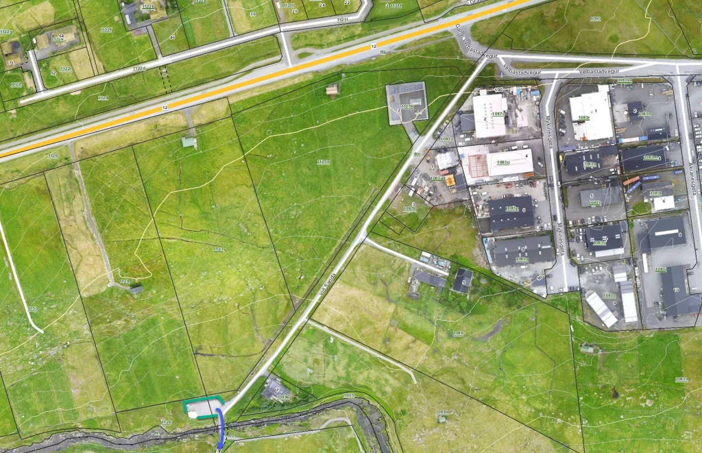 See green line for parking and blue line for starting point
 -
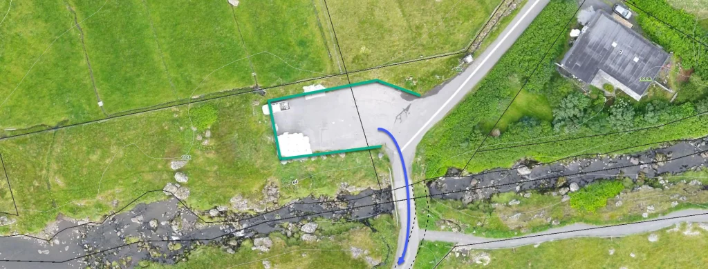 See green line for parking and blue line for starting point
 -
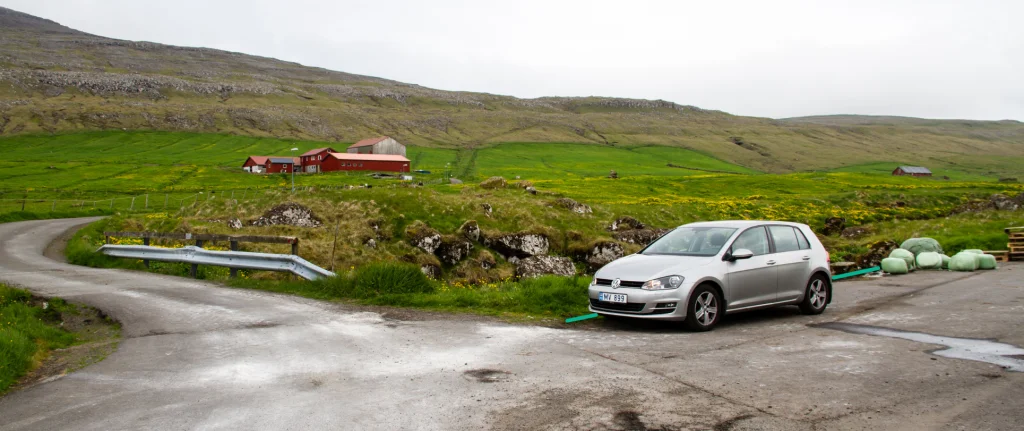 See green line for parking


Kirkjubøur - Tórshavn
Public Transport
The municipal buses in Tórshavn go quite frequently to Kirkjubøur. For departure times, look up route 6 (mon-fri) and route 8 (sat & sun). You can plan your trip here.
Arriving by car
Parking, Kirkjubøur
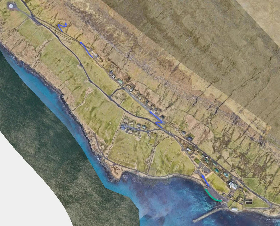
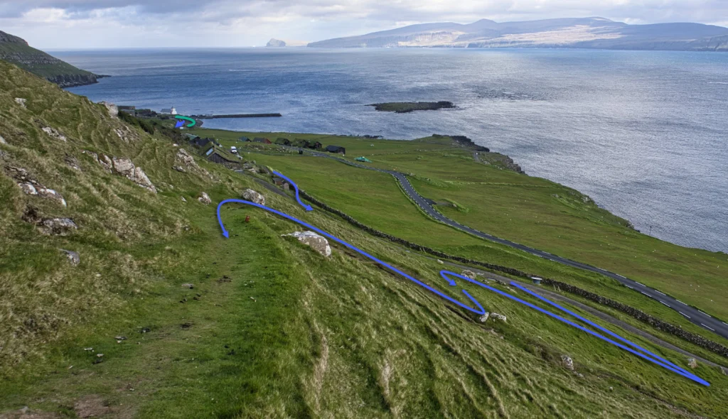
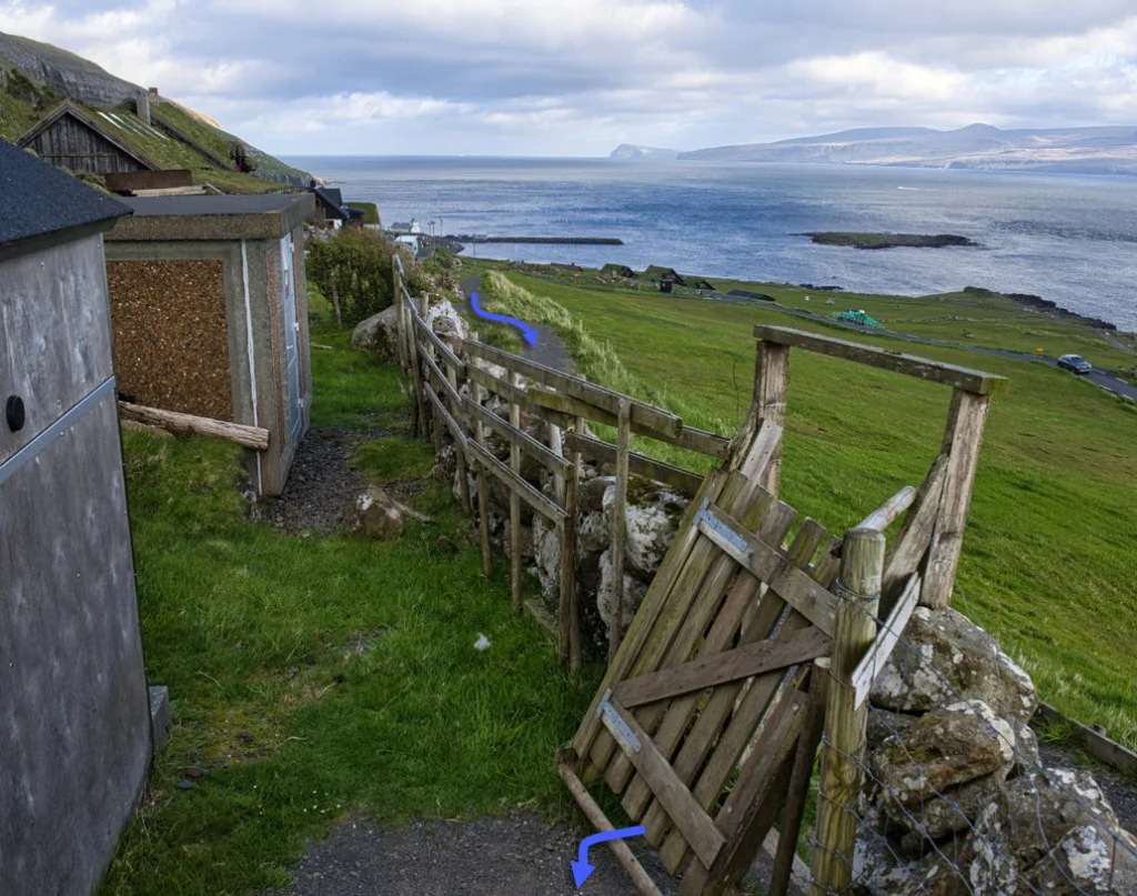
You can park your car in the public parking lot down by the harbour in Kirkjubøur, close to the church—see the green line. From there, walk along the main road for about 825 metres, north to the cattle grid, where the village path starts—see the blue line in the picture.
-
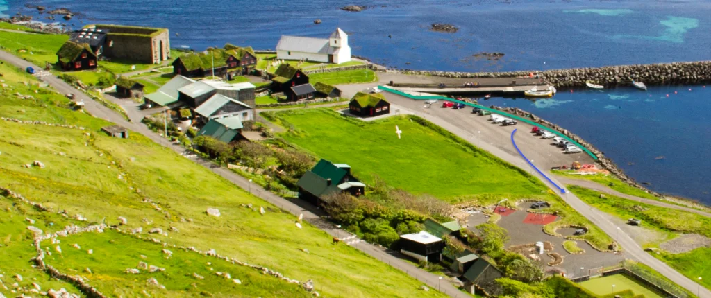 See green line for parking and blue line for starting point.
 -
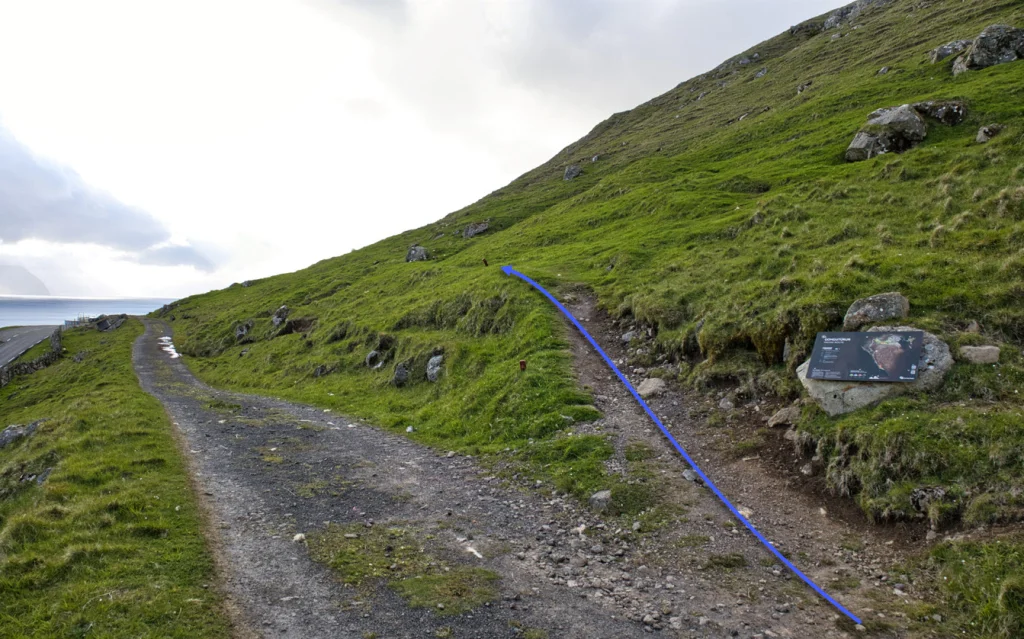
-
-
-


Tórshavn - Kirkjubøur
Kirkjubøur - Tórshavn
Fakta

Tíð

longd

Hægsta stað

Hæddarmetrar
 Suitable for children over 6 years, accompanied by adults.
Kindergarteners and school children often go on this hike. Care must be taken on the stretch down to Kirkjubøur, which is a little steep
Suitable for children over 6 years, accompanied by adults.
Kindergarteners and school children often go on this hike. Care must be taken on the stretch down to Kirkjubøur, which is a little steep
 Medium
- It is a little steep when you depart from Tórshavn and when you approach Kirkjubøur
Medium
- It is a little steep when you depart from Tórshavn and when you approach Kirkjubøur
 The first stretch up from Tórshavn is a little bumpy and rocky. If it has been raining and many people have taken the path, it can be muddy in places.



Øki / Torleikastig

 Avbjóðandi
 10 km /
2t
20m
10 km /
2t
20m

 4 km /
1t
4 km /
1t


