


Tú hevur ongar yndis enn
Her kanst tú savna íblástur, greinar, tiltøk og støð, sum tú hevur áhuga fyri.
Trýst á ikonið á síðurnar, so koma tær fram her.
Tínir yndis
Íblástur & Greinir
Tiltøk & Túrar
Støð
Bygdagøtur
INSPIRATIÓNIR & ARTIKLAR
TILTØK & GONGUTÚRAR
Støð
Hov- Øravík


Link Copied!

-
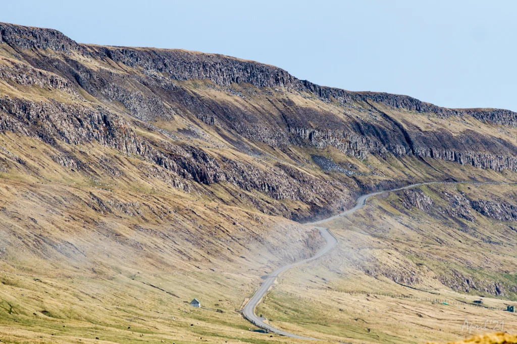 The old road between Hov and Øravík. Photo: Óli Gardshodn
 -
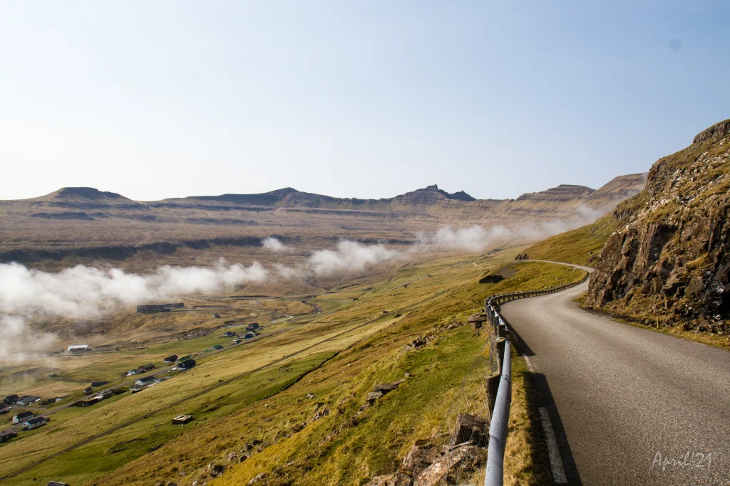 On the old road above Hov, where the path starts. Photo: Óli Gardshodn
 -
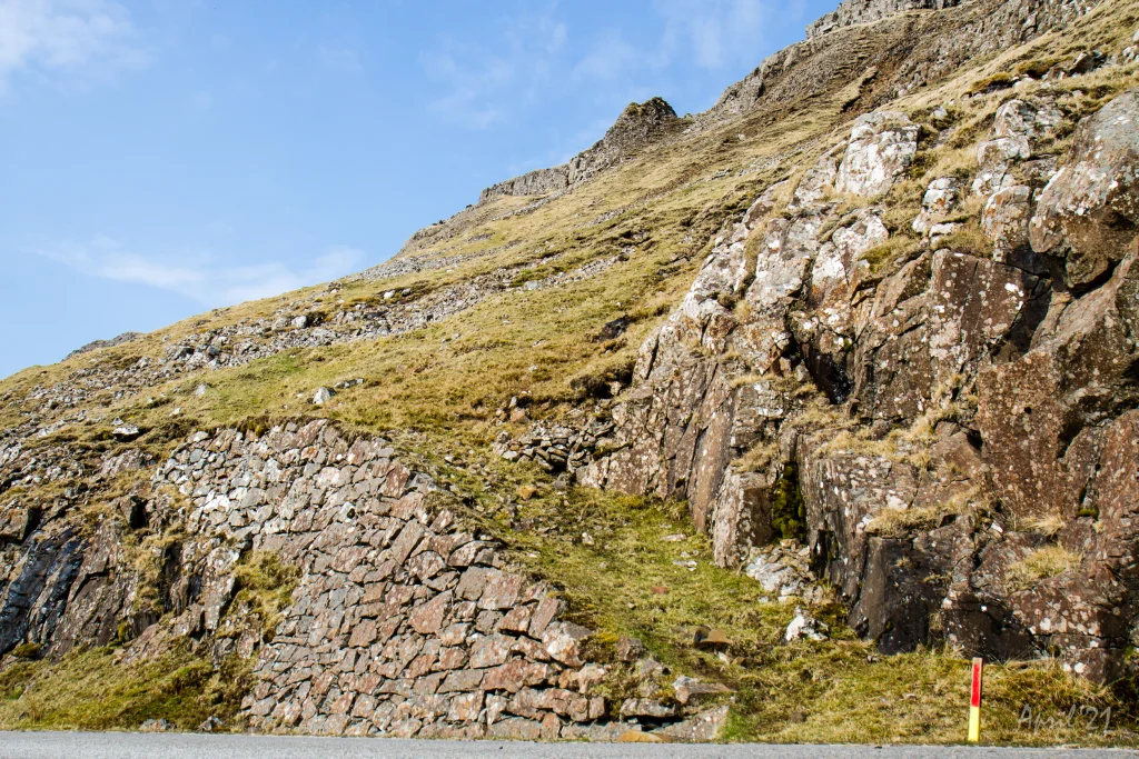 On the old road above Hov, where the path starts. At the top centre of the picture is Tindurin, which you walk up along on the east side (on the right side of the picture). Photo: Óli Gardshodn
 -
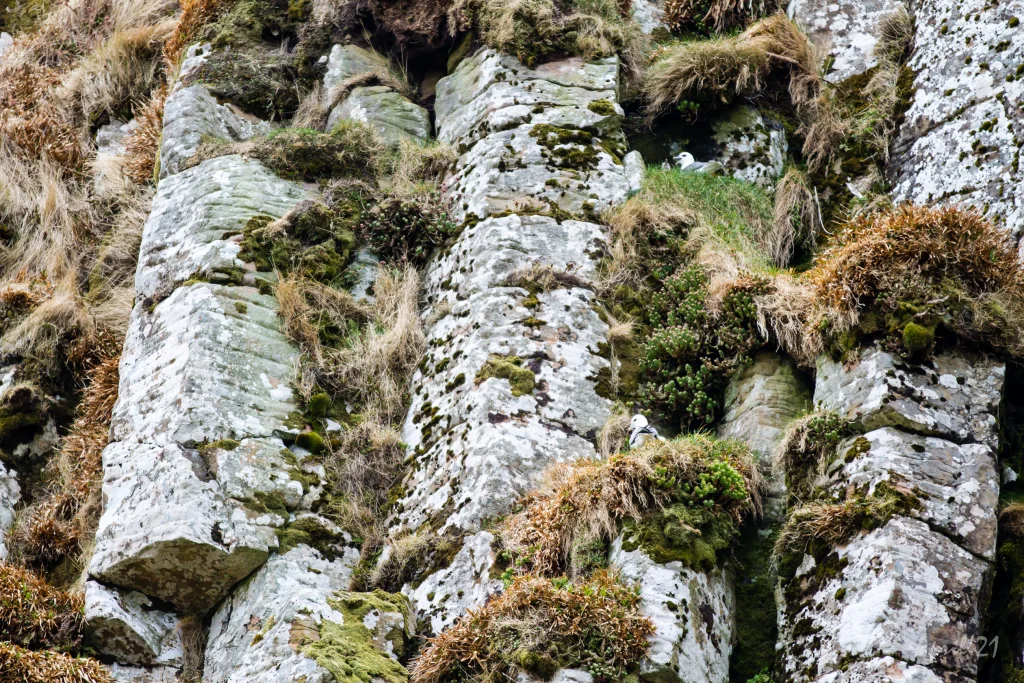 Columnar Basalt just above where the trail begins. Photo: Óli Gardshodn
 -
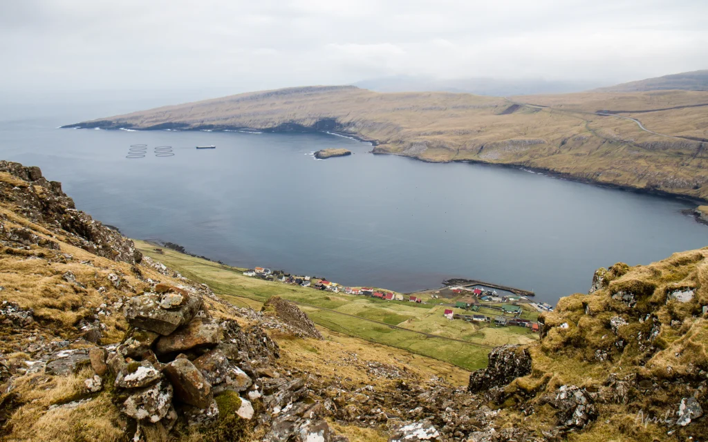 View of the village of Hov. In the background the headland of Porkerisnes. Photo: Óli Gardshodn
 -
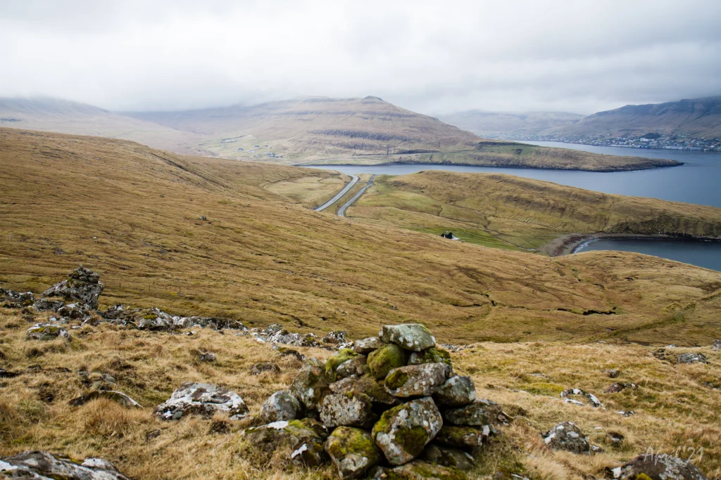 View up from Gøturygsskarð over the fjord Trongisvágsfjørð. Photo: Óli Gardshodn
 -
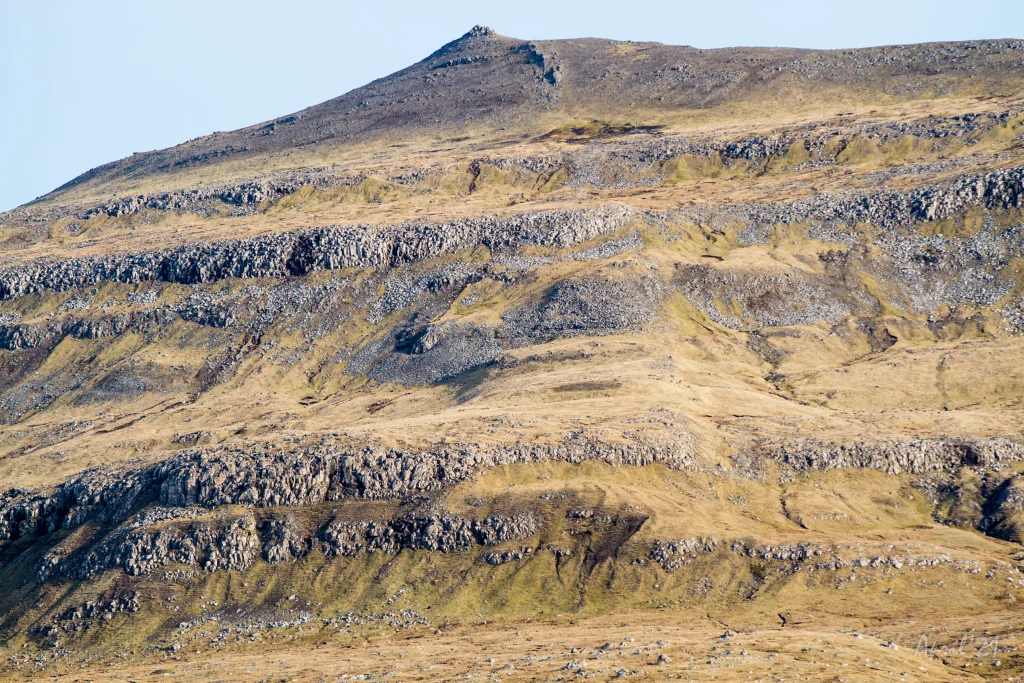 The outfield Hjallaskorahagi with the mountain Hovstúgvu in the background. The village path is in a straight line from the left side of the top, down Gøturyggi and from there down to the right corner of the picture. Photo: Óli Gardshodn
 -
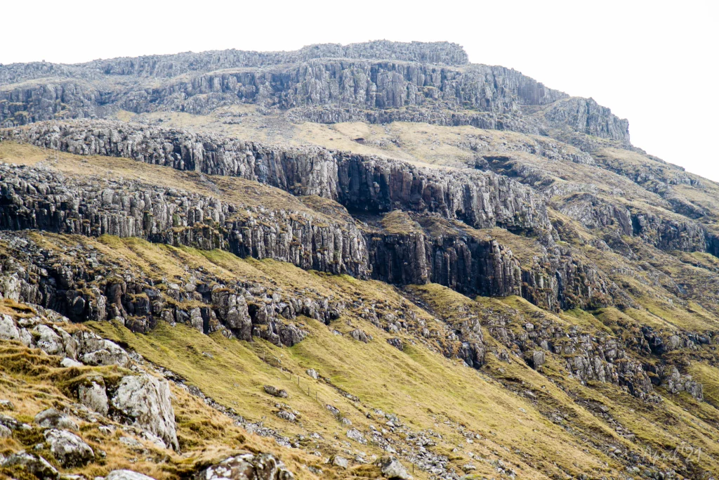 Stony landscape along the path. Photo: Óli Gardshodn
 -
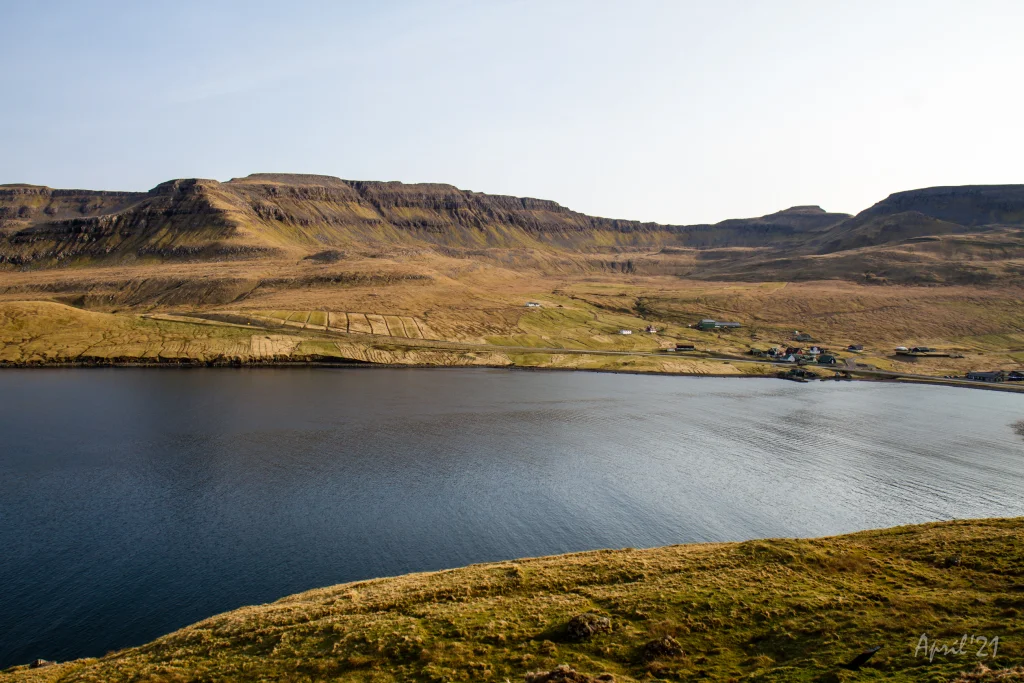 View over Øravík. The village path from Hov comes in from the left side on the picture. Photo: Óli Gardshodn
 -
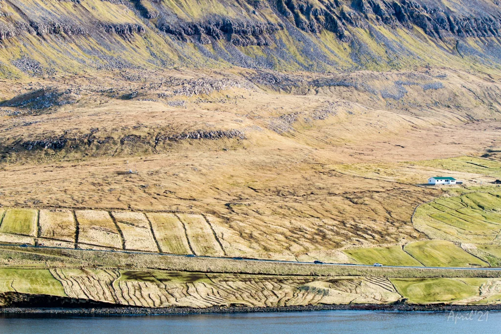 The eastern end of the village Øravík, where the village path enters through the place Kaldakinn, which can be seen in the middle of the picture. Photo: Óli Gardshodn
 -
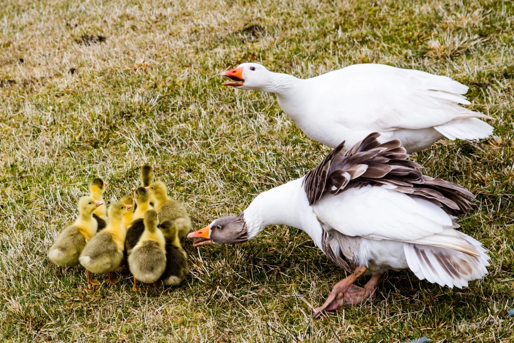 Flock of Geese in the village Øravík. Photo: Óli Gardshodn


-
The old road between Hov and Øravík. Photo: Óli Gardshodn
-
On the old road above Hov, where the path starts. Photo: Óli Gardshodn
-
On the old road above Hov, where the path starts. At the top centre of the picture is Tindurin, which you walk up along on the east side (on the right side of the picture). Photo: Óli Gardshodn
-
Columnar Basalt just above where the trail begins. Photo: Óli Gardshodn
-
View of the village of Hov. In the background the headland of Porkerisnes. Photo: Óli Gardshodn
-
View up from Gøturygsskarð over the fjord Trongisvágsfjørð. Photo: Óli Gardshodn
-
The outfield Hjallaskorahagi with the mountain Hovstúgvu in the background. The village path is in a straight line from the left side of the top, down Gøturyggi and from there down to the right corner of the picture. Photo: Óli Gardshodn
-
Stony landscape along the path. Photo: Óli Gardshodn
-
View over Øravík. The village path from Hov comes in from the left side on the picture. Photo: Óli Gardshodn
-
The eastern end of the village Øravík, where the village path enters through the place Kaldakinn, which can be seen in the middle of the picture. Photo: Óli Gardshodn
-
Flock of Geese in the village Øravík. Photo: Óli Gardshodn
Eftir bratta og avbjóðandi túrin niðan á Tindin er restin av túrinum ein stutt mótbrekka niðan undir Hovstúgvu (Túgvuna í Halgafelli), og síðan ein long og hugnalig undanbrekka oman til Øravíkar við góðum útsýni inn yvir Trongisvágsfjørð.
Hov - Øravík
Túrurin byrjar miðskeiðis á Hovsvegnum niðan á Hovsegg, í 180 metra hædd, áraka bátahylin í Hovi. 70 hæddarmetrar omanfyri er eyðkendi Tindurin, sum gangast skal niðan gjøgnum. Fyrsti sjónligi varðin stendur ovast í stígginum niðan gjøgnum Tindin.
Hetta sær bratt og avbjóðandi út, men ein góðan summardag hevur hetta onki upp á seg uttan kanska hjá tí, sum hevur hæddarræðslu.
Tíverri er gøtan undir Tindinum ikki hildin. Hetta sæst eisini á einum varða undir Tindinum, sum hálvur er farin í einari skriðu, umframt at alt ov nógv leyst grót og tilfar liggur á leiðini. So her er bara um at geva sær góða tíð og finna sær eitt gott vallað stað at ganga niðan gjøgnum.
Komin niðan á Tindin er lættari at ganga, og stutt er niðan á Skarðið í Kambi – bert 30 hæddarmetrar.
Útsýnið her uppi er avbera gott yvir Hov, Hovsfjørð og inn í Hovsdal.
Haðani er ein stutt og lítil mótbrekka niðan eystan fyri Hovstúgvu (Túgvuna í Halgafelli).
Eftir at komið er um sýnina, byrjar ein long og lagalig undanbrekka allan vegin oman til Øravíkar. Meðan vit ganga oman fram við tøttu varðunum, njóta vit góða, vakra útsýnið inn gjøgnum Trongisvágsfjørð.
Tíverri er hegnað við innkomuna til Øravíkar við ikki minni enn tveimum hegnum, annað við píkatráði. Gongufólk mugu tí finna eitt trygt stað at fara uppum hegnið, til avvarðandi partar hava tryggja eina góða og lætta farleið eftir bygdagøtuni.


Hov-Øravík
Public transport
There is a good connection between Hov and Øravík with route 700.
From the closest bus stop in Hov, you must walk up, along the old road between Hov and Øravík.
Parking in Hov
Cars can be parked at the large parking area by the road towards “Hovsegg”. Park only on the lower side of the road due to the danger of small stones rolling onto the road – (green markings on the photo).
From here, walk along the blue line, where a path following the main road towards Tindur has been made.
-
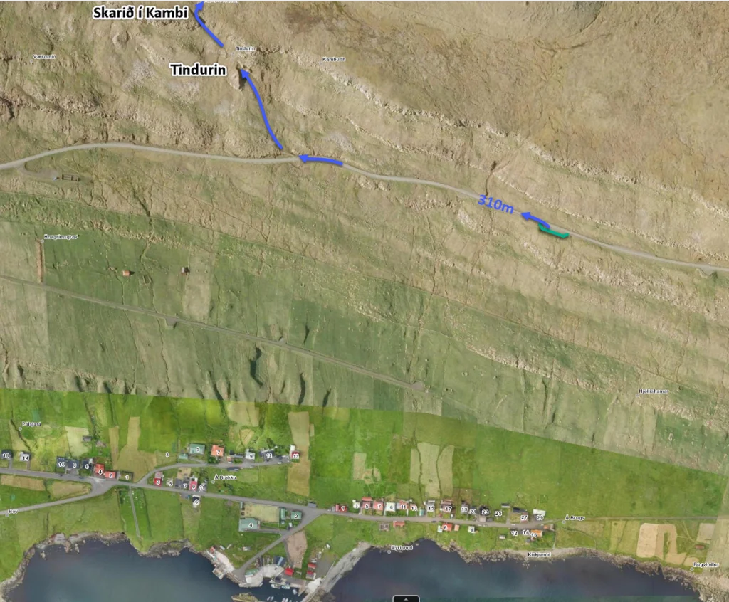 See green line for parking and blue line for starting point
 -
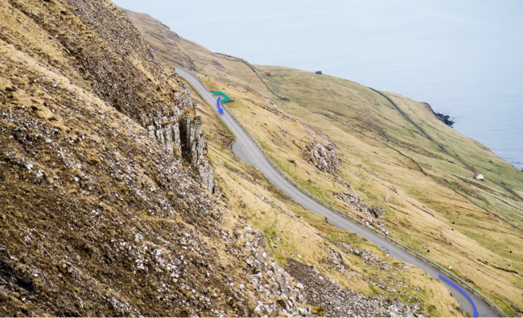 See green line for parking and blue line for starting point. Park only on the lower side of the road due to the danger of small stones rolling onto the road
 -
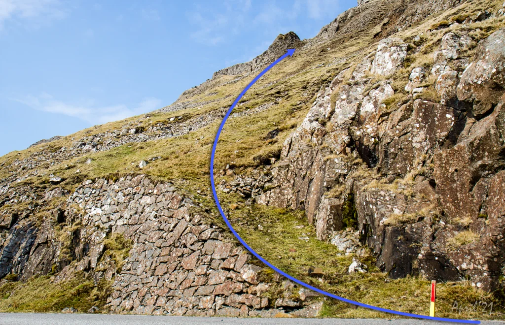 The blue line shows the path up along the east (right) side of Tindurin


Øravík - Hov
Public transport
There is a good connection between Hov and Øravík with route 700.
From the closest bus stop in Hov, you must walk up, along the old road between Hov and Øravík.
Parking in Øravík
Park by the prayer house – check the green markings. Tvøroy Council advises you to up by the upperside houses. Then across the barb-wired fence. Check blue arrows on the photo. Then walk towards the first stone cairn, which becomes visible on high ground. Check red markings.
-
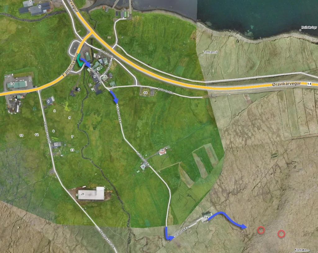 See green line for parking, blue line for starting point and read circles for the first cairns. The parking lot marked with green lines is just beside the adress Bóndatún 1, Ørðavík
 -
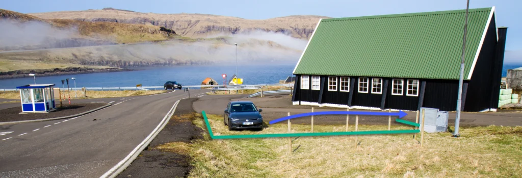 See green line for parking and blue line for starting point. The parking lot marked with green lines is just beside the adress Bóndatún 1, Ørðavík
 -
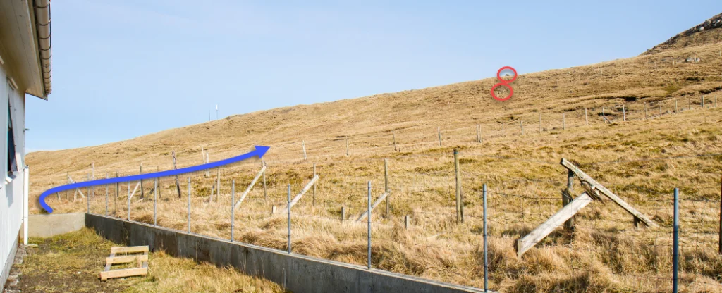 As you go out through the place at Lítlabrekka 38 in Øravík - see blue line, head to the cairns marked with read circles on the picture.


Hov - Øravík
Øravík - Hov
Fakta

Tíð

longd

Hægsta stað

Hæddarmetrar
 In the beginning of the route above Hov, adults are advised to be extremely cautious about their children's safety.
 Medium
- This is an excellent route to take for those who are careful, physically capable and not afraid of heights. But the first 70-meter walk from the main road in Hovi and the ascent of Tindurin are steep stretches and can be difficult for some people. From the top of Tindur it is easy and relatively flat to walk the rest of the way to Øravík.
Medium
- This is an excellent route to take for those who are careful, physically capable and not afraid of heights. But the first 70-meter walk from the main road in Hovi and the ascent of Tindurin are steep stretches and can be difficult for some people. From the top of Tindur it is easy and relatively flat to walk the rest of the way to Øravík.
 The terrain is decent and mostly grass-covered, except just below Hov. There the path is unkempt, and rather stony, amidst the otherwise grassy area around the main road towards Tindur.

Øki / Torleikastig

 Avbjóðandi
 42 km /
16t
42 km /
16t

 2 km /
1t
2 km /
1t

 6 km /
2t
6 km /
2t


