


Tú hevur ongar yndis enn
Her kanst tú savna íblástur, greinar, tiltøk og støð, sum tú hevur áhuga fyri.
Trýst á ikonið á síðurnar, so koma tær fram her.
Tínir yndis
Íblástur & Greinir
Tiltøk & Túrar
Støð
Bygdagøtur
INSPIRATIÓNIR & ARTIKLAR
TILTØK & GONGUTÚRAR
Støð
Langasandur - Streymnes


Link Copied!

-
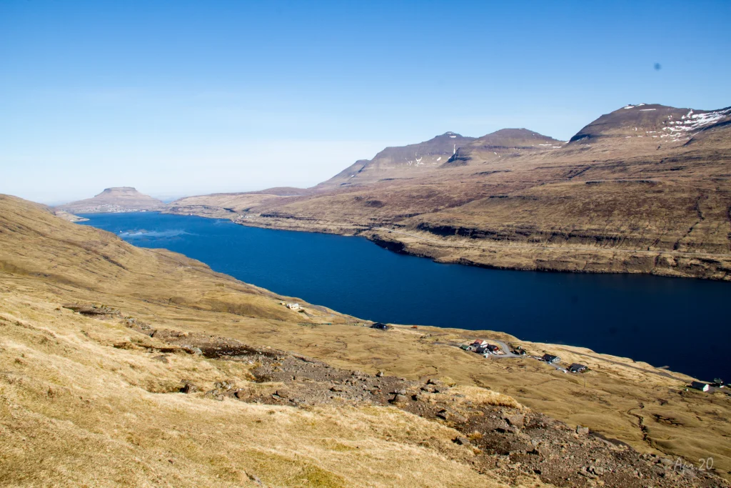 View from Stígarnir, above the village of Langasandur, over the strait between the islands Streymoy and Eysturoy. In the background the village of Eiði. Photo: Óli Gardshodn
 -
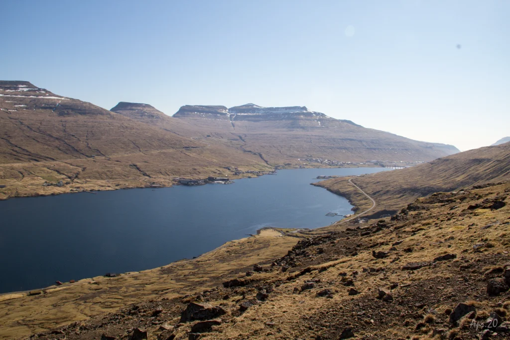 View from Stígarnir, over the village of Langasandur, over the strait between the islands of Streymoy and Eysturoy. In the background the bridge over the strait. Photo: Óli Gardshodn
 -
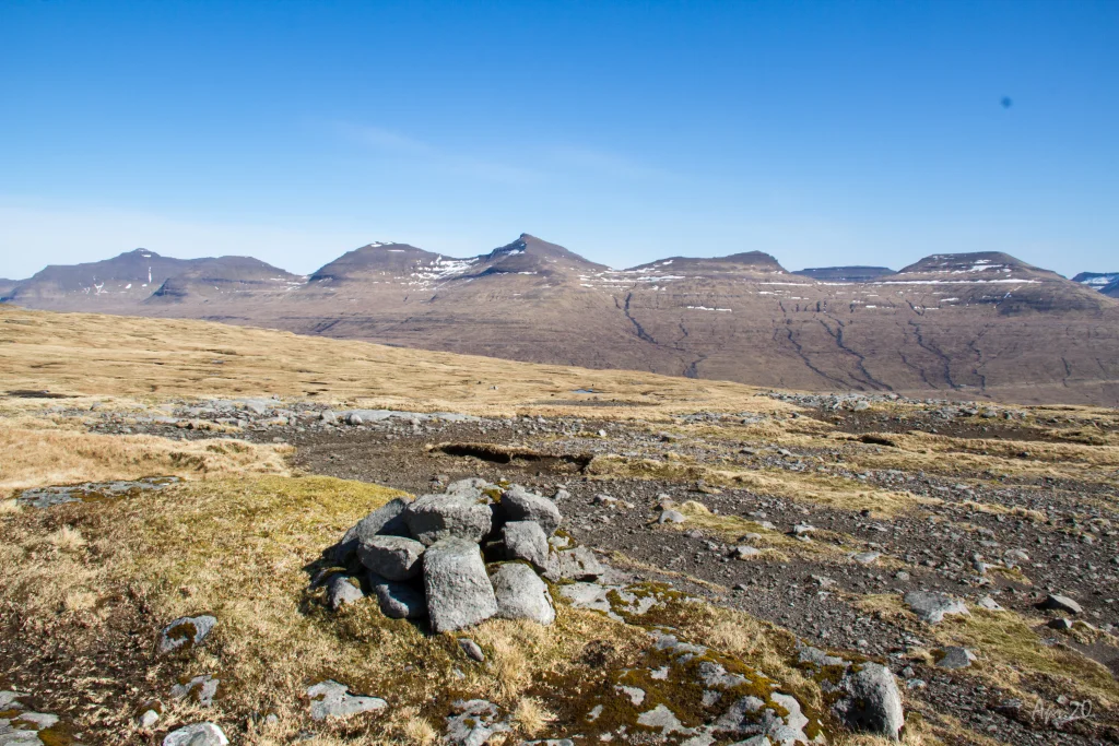 The highest point on the route at 354m. the cairn at the pass Streymneshálsur. Photo: Óli Gardshodn
 -
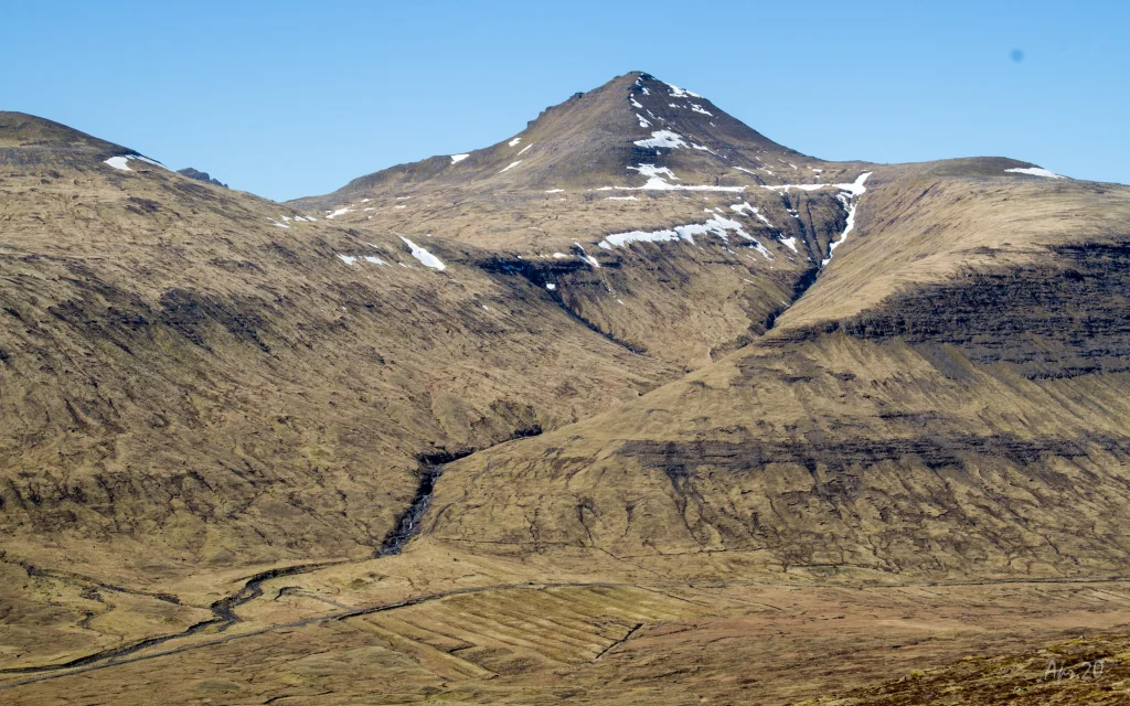 The mountain Ørvisfelli in Saksunardali. With its 783m. is the second highest mountain on Streymoy. The village path between Saksun and Vestmanna goes up through the valley to the left of Ørvisfelli. Photo: Óli Gardshodn
 -
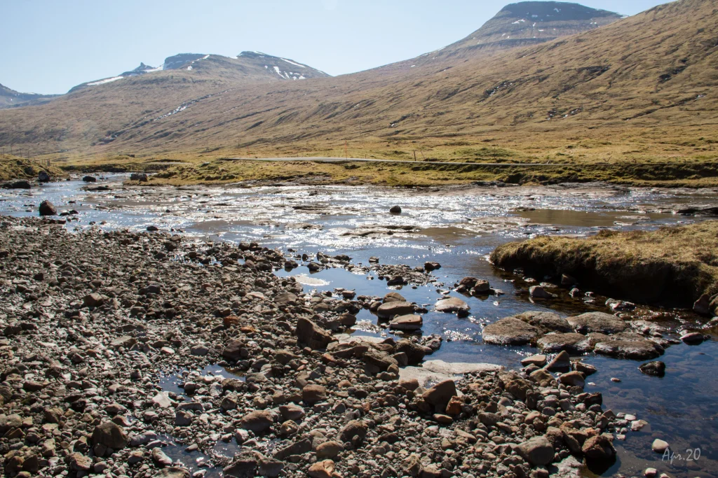 Stórá in Saksunardalur. If it has been dry for a few days, it is easy to get across the river. Otherwise, if much water is in the river, you need to wade or walk 800 m. north up to the bridge. Photo: Óli Gardshodn


-
View from Stígarnir, above the village of Langasandur, over the strait between the islands Streymoy and Eysturoy. In the background the village of Eiði. Photo: Óli Gardshodn
-
View from Stígarnir, over the village of Langasandur, over the strait between the islands of Streymoy and Eysturoy. In the background the bridge over the strait. Photo: Óli Gardshodn
-
The highest point on the route at 354m. the cairn at the pass Streymneshálsur. Photo: Óli Gardshodn
-
The mountain Ørvisfelli in Saksunardali. With its 783m. is the second highest mountain on Streymoy. The village path between Saksun and Vestmanna goes up through the valley to the left of Ørvisfelli. Photo: Óli Gardshodn
-
Stórá in Saksunardalur. If it has been dry for a few days, it is easy to get across the river. Otherwise, if much water is in the river, you need to wade or walk 800 m. north up to the bridge. Photo: Óli Gardshodn
Ein lættur túrur tvørtur um tann slætta Langasandshagan, har fleiri áir renna, og gott útsýni er yvir Sundini og Saksunardal
Komin niðan frá Langasandi verður fyrst gingið suður eftir Ryssheiðum og Slættanum, eitt vakurt, slætt og hugnaligt øki beint oman fyri Langasand. Haðani gongur leiðinniðan gjøgnum Stígarnar. Hetta er eitt sindur tungt, men her er gott og vallað at ganga. Restin av túrinum er løtt.
Í Langasandshaganum verður fyrst gingið tvørtur um ta vøkru Norðaru Gjánagjógvará, síðan ein góðan kilometur eftir slættanum, til komið verður niðan á Streymnesháls. Haðani verður gingið oman í Saksunardal, meginpartin av teininum verður gingið fram við tí hugnaligu Streymnesánni og tí hugtakandi bratta økinum við Streymnesfossum.
Tá ið komið er oman á slætt, skal ein tvørtur um ta vøkru Dalánna fyri at koma til høvuðsvegin. Um summarið, tá ið turt er, er hampiligt at koma tvørtur um ánna í vanligum fjallaskóm, tó kann hellan í ánni vera hál at ganga eftir. Um tað hevur regnað, er áin munandi størri, og tá er kanska neyðugt at vassa yvirum. Eisini ber til at ganga niðan til brúnna um Dalá, 800 m longri uppi.
Fá fólk ganga hendan túrin, so her er sera friðarligt. Útsýnið yvir Sundini, Saksunardal og øll fjøllini rundanum er vakurt og fjøltáttað.
Tvørtur um Dalánna skal verða leitað eftir besta staðnum at ganga tvørturum. Um veðrið loyvir tí, ber til at ganga frá snippinum av tunguni millum Dalá og Streymnesánna, fyrst nakrar metrar omaneftir og síðan beint tvørturum – sum gpx-fílan eisini vísir.


Langasandur - Streymnes
Public transport
There is no bus-stop in Langasandur. The closest bus-stop is in Oyrabakki, which is a bus-stop for a few routes, incl. Tórshavn.
Arriving by car
Parking, Langasandur
Parking is available at the end of the road Rættargøta. Walk through the sheep pen and through an opening in the fence just outside the pen. (see the photo)
-
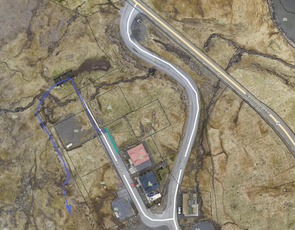 parking (green) and starting point (blue)
 -
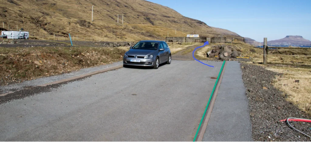 parking (green) and starting point (blue)
 -
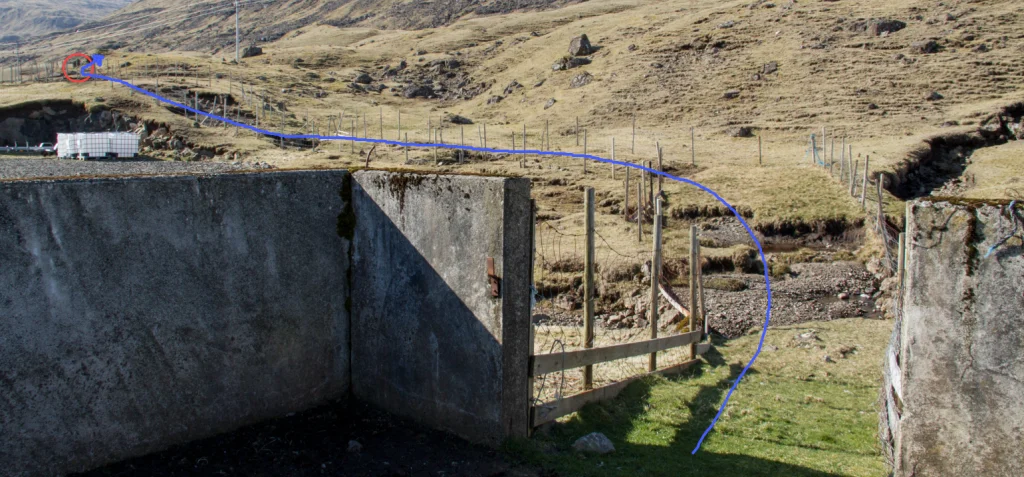 starting point (blue)


Streymnes - Langasandur
Public transport
Route 450 stops in Hvalvík (next to Streymnes)
Arriving by car
The path begins in the valley Saksunardalur, about 3.8 km from the bus stop in Hvalvík.
A fairly big parking lot is close by. From there, cross the river Dalá and follow the river Streymnesá. (see the photos)
-
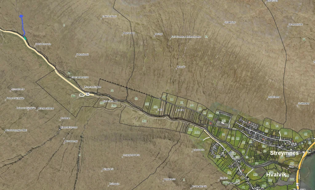 starting point (blue)
 -
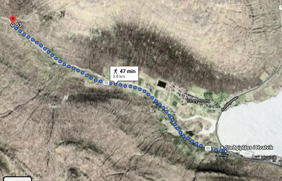 from bus stop to starting point
 -
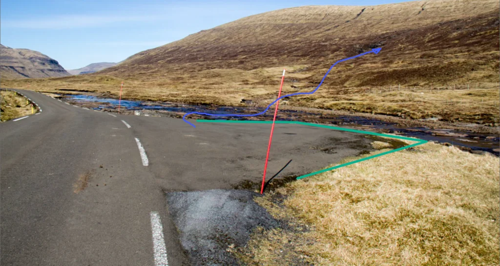 parking (green) and starting point (blue)
 -
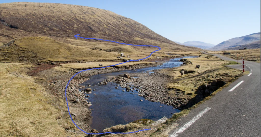 starting point (blue)


Langasandur - Streymnes
Streymnes - Langasandur
Fakta

Tíð

longd

Hægsta stað

Hæddarmetrar
 Suitable for kids above 6 years
 Medium
- It can be a challenge to find the right place to cross Dalá if waters are high, even though the river is shallow and its current weak. Smaller children will most likely need to be carried across. Another option is to walk 800 metres toward Saksun, where a bridge crosses the river
Medium
- It can be a challenge to find the right place to cross Dalá if waters are high, even though the river is shallow and its current weak. Smaller children will most likely need to be carried across. Another option is to walk 800 metres toward Saksun, where a bridge crosses the river
 Grass-covered for the most part. There is quite a bit of heather by the river Streymnesá, turning a little rocky by the water falls Streymnesfossar

Øki / Torleikastig

 Avbjóðandi
 8 km /
2t
30m
8 km /
2t
30m


 16 km /
5t
30m
16 km /
5t
30m


