


Tú hevur ongar yndis enn
Her kanst tú savna íblástur, greinar, tiltøk og støð, sum tú hevur áhuga fyri.
Trýst á ikonið á síðurnar, so koma tær fram her.
Tínir yndis
Íblástur & Greinir
Tiltøk & Túrar
Støð
Bygdagøtur
INSPIRATIÓNIR & ARTIKLAR
TILTØK & GONGUTÚRAR
Støð
Øravík - Vágur


Link Copied!

-
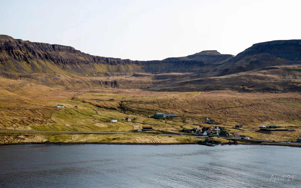 View over the southern part of the village of Øravík. The village path to Vágur goes up through this valley and up through the pass Mannaskarð that is located just to the left of the mountain Laðanfelli in the middle. To the right Mt. Nónfjall (427m.). Photo: Óli Gardshodn
 -
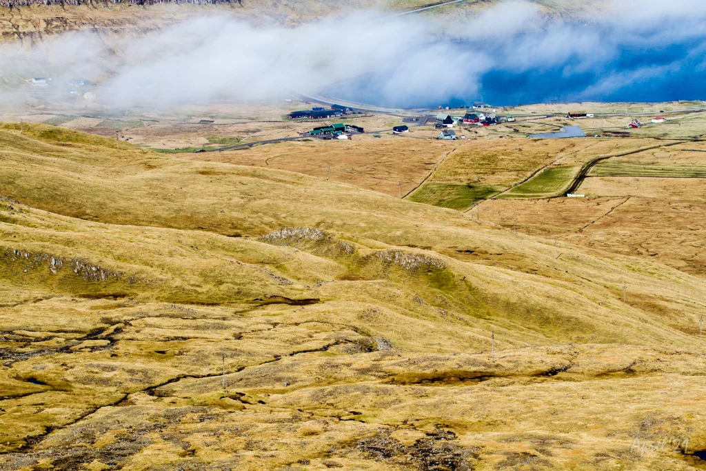 View from the pass Mannaskarð over the village Øravík. Far left just below the centre of the image is the lower part of Tingstovan, the ancient thingstead of Suðuroy, also called "Uppi millum Stovur". Photo: Óli Gardshodn
 -
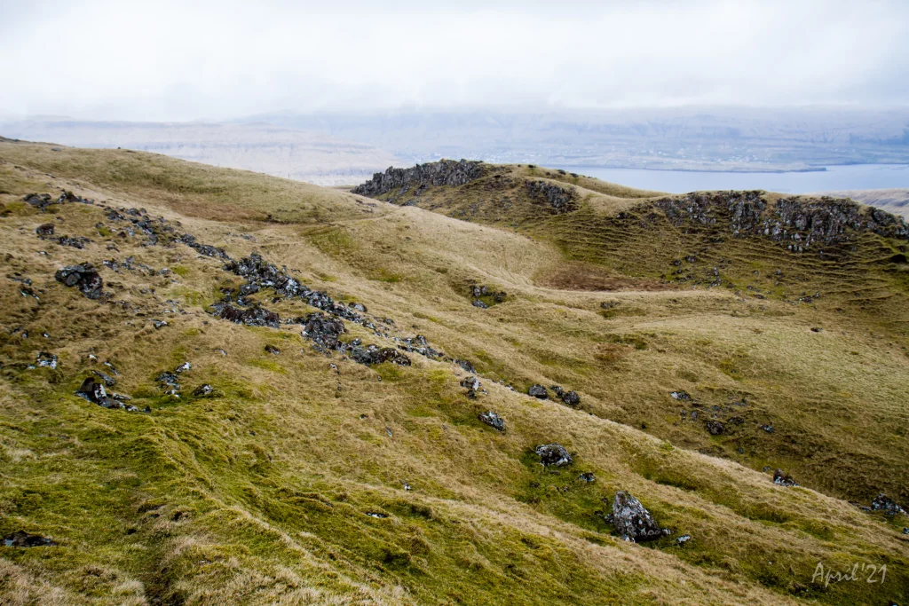 On the way up from the village of Øravík, we walk along Rossatindur, the small knoll in the picture, where the horses of those who were present at Tingstovan were tethered. This area is characterized by hills and knolls that are formed due to a special geological pressure phenomenon. Photo: Óli Gardshodn
 -
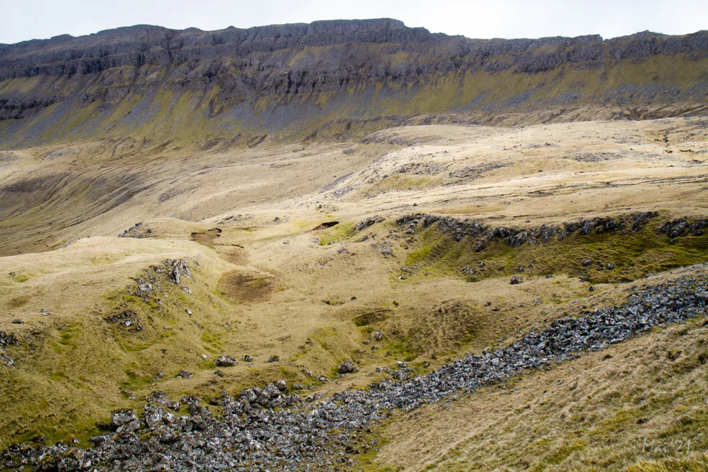 View over Tingstovan, the ancient thingstead of Suðuroy, also called "Uppi millum Stovur". Photo: Óli Gardshodn
 -
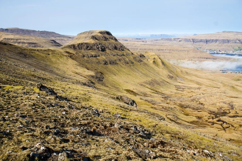 From the pass Mannaskarð we have a good view over the valley above the village Øravík and the mountain Nónfjall (427m.) on the left side, as well as the old thingstead Tingstovan, located at the foot of Nónfjall. On a clear day we can also see the islands north of Suðuroy. To the right we can see a glimpse of the village Øravík with Tvøroyri on the other side of the fjord Trongisvágsfjørður. Photo: Óli Gardshodn
 -
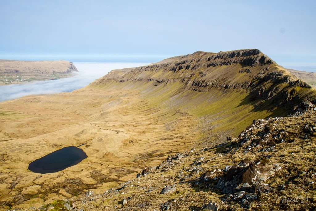 View from the pass Mannaskarð over the valley up from Øravík village. To the left is lake Nykavatn with Mt. Enni (424m.) to the right. In the background the village Froðba. Photo: Óli Gardshodn
 -
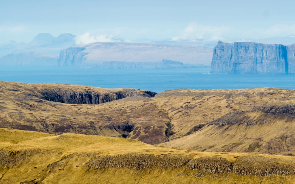 The view from the pass Mannaskarð across Trongisvágur and the deep and beautiful valley Hvannhagi. In the background the islands of Skúgoy and Sandoy. In the distant background, the radar on Mt. Sornfelli (749m.) and Mt. Skælingur (767m.) 62km and 65km away respectively. Photo: Óli Gardshodn
 -
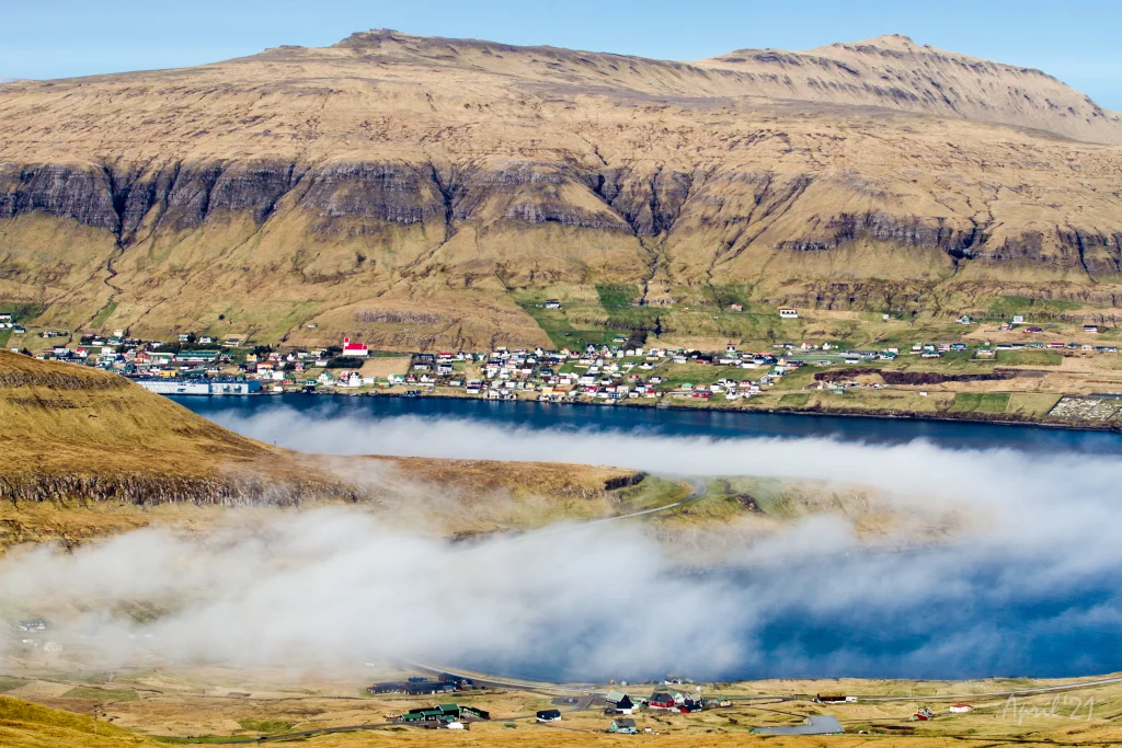 View from Mannaskarð over the fjord Trongisvágsfjørður with the village Øravík in the foreground and Tvøroyri and Froðba in the background. Photo: Óli Gardshodn
 -
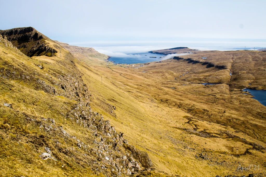 View of the village Hov from the pass Mannaskarð. To the right you can just see the lake Vatnsnes come into view. Photo: Óli Gardshodn
 -
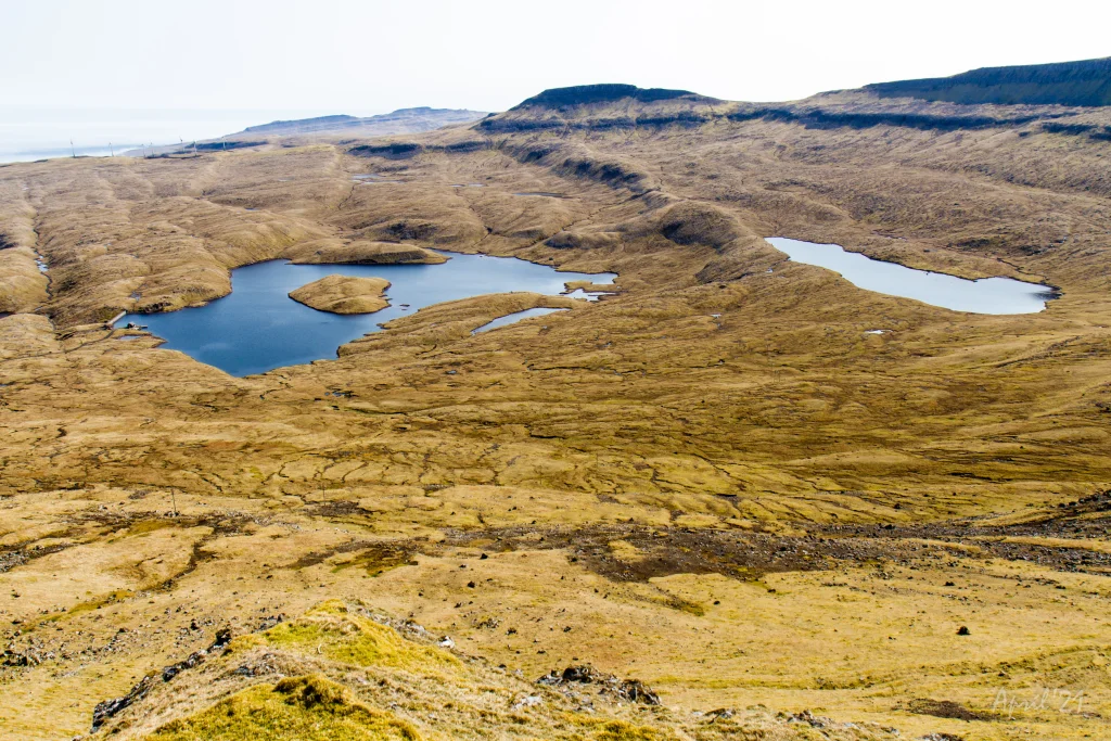 View from the pass Mannaskarð over the valley of Hov and the large lakes Vatnsnes and Bessavatn. Photo: Óli Gardshodn
 -
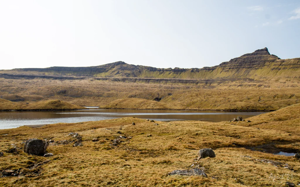 Down by the parking lot near the lake Vatnsnes in the valley above the village Hov. Farthest to the left is the pass Vágsskarð, which we have to cross to get to the village Vágur. The mountain in the middle is Hvannafelli (560m), and to the right the majestic Borgarknappur (574m.). Photo: Óli Gardshodn
 -
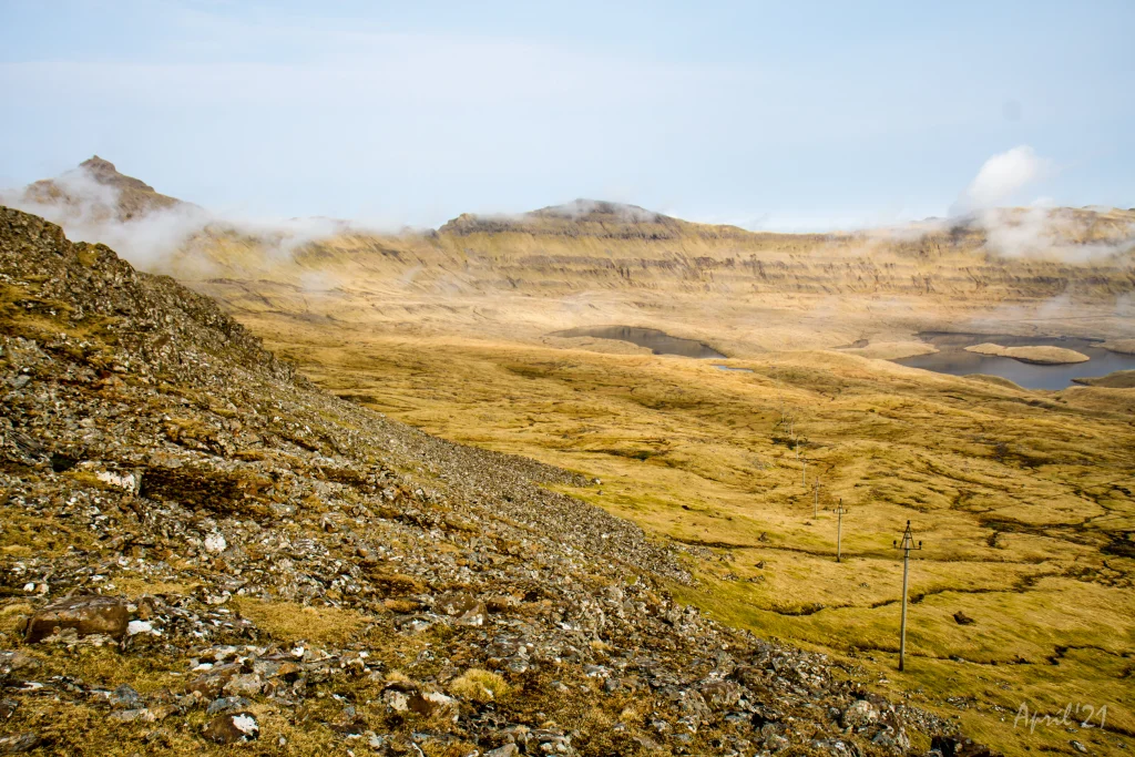 View just below the pass Vágsskarð across the valley Hovsdalur. The village trail goes between the lakes Bessavatn and Vatnsnes and up over the pass Mannaskarð which is just to the right of the mountain in the middle. The mountains from left to right are Borgarknappur (574m.), Laðanfelli (485m.) and Enni (424m.). Photo: Óli Gardshodn
 -
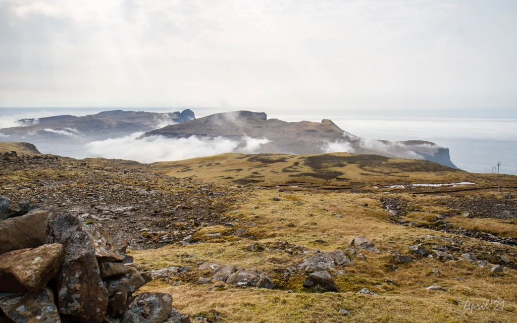 View from the pass Vágsskarð in a southerly direction. Farthest away, slightly to the left, the famous promontory Beinisvørð (470m.). In the middle are the mountains Rávan (432.) and Rútafelli (356m.). Photo: Óli Gardshodn
 -
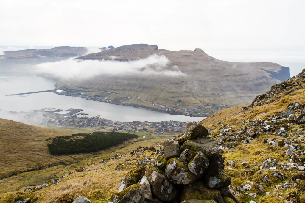 View down the valley Hvannadalur and the village Vágur. The upper part is fairly steep. Photo: Óli Gardshodn
 -
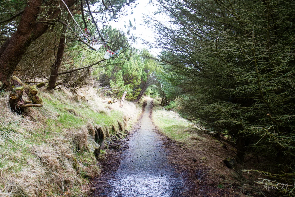 The village path runs through the cozy forest of the village of Vágur. Here the children in the village go up to hang their pacifiers to get rid of them. Photo: Óli Gardshodn


-
View over the southern part of the village of Øravík. The village path to Vágur goes up through this valley and up through the pass Mannaskarð that is located just to the left of the mountain Laðanfelli in the middle. To the right Mt. Nónfjall (427m.). Photo: Óli Gardshodn
-
View from the pass Mannaskarð over the village Øravík. Far left just below the centre of the image is the lower part of Tingstovan, the ancient thingstead of Suðuroy, also called "Uppi millum Stovur". Photo: Óli Gardshodn
-
On the way up from the village of Øravík, we walk along Rossatindur, the small knoll in the picture, where the horses of those who were present at Tingstovan were tethered. This area is characterized by hills and knolls that are formed due to a special geological pressure phenomenon. Photo: Óli Gardshodn
-
View over Tingstovan, the ancient thingstead of Suðuroy, also called "Uppi millum Stovur". Photo: Óli Gardshodn
-
From the pass Mannaskarð we have a good view over the valley above the village Øravík and the mountain Nónfjall (427m.) on the left side, as well as the old thingstead Tingstovan, located at the foot of Nónfjall. On a clear day we can also see the islands north of Suðuroy. To the right we can see a glimpse of the village Øravík with Tvøroyri on the other side of the fjord Trongisvágsfjørður. Photo: Óli Gardshodn
-
View from the pass Mannaskarð over the valley up from Øravík village. To the left is lake Nykavatn with Mt. Enni (424m.) to the right. In the background the village Froðba. Photo: Óli Gardshodn
-
The view from the pass Mannaskarð across Trongisvágur and the deep and beautiful valley Hvannhagi. In the background the islands of Skúgoy and Sandoy. In the distant background, the radar on Mt. Sornfelli (749m.) and Mt. Skælingur (767m.) 62km and 65km away respectively. Photo: Óli Gardshodn
-
View from Mannaskarð over the fjord Trongisvágsfjørður with the village Øravík in the foreground and Tvøroyri and Froðba in the background. Photo: Óli Gardshodn
-
View of the village Hov from the pass Mannaskarð. To the right you can just see the lake Vatnsnes come into view. Photo: Óli Gardshodn
-
View from the pass Mannaskarð over the valley of Hov and the large lakes Vatnsnes and Bessavatn. Photo: Óli Gardshodn
-
Down by the parking lot near the lake Vatnsnes in the valley above the village Hov. Farthest to the left is the pass Vágsskarð, which we have to cross to get to the village Vágur. The mountain in the middle is Hvannafelli (560m), and to the right the majestic Borgarknappur (574m.). Photo: Óli Gardshodn
-
View just below the pass Vágsskarð across the valley Hovsdalur. The village trail goes between the lakes Bessavatn and Vatnsnes and up over the pass Mannaskarð which is just to the right of the mountain in the middle. The mountains from left to right are Borgarknappur (574m.), Laðanfelli (485m.) and Enni (424m.). Photo: Óli Gardshodn
-
View from the pass Vágsskarð in a southerly direction. Farthest away, slightly to the left, the famous promontory Beinisvørð (470m.). In the middle are the mountains Rávan (432.) and Rútafelli (356m.). Photo: Óli Gardshodn
-
View down the valley Hvannadalur and the village Vágur. The upper part is fairly steep. Photo: Óli Gardshodn
-
The village path runs through the cozy forest of the village of Vágur. Here the children in the village go up to hang their pacifiers to get rid of them. Photo: Óli Gardshodn
Ein túrur niðan gjøgnum Tingstovuna oman fyri Øravík at njóta góða útsýnið av Mannaskarði, haðani hugnaliga túrin tvørtur um Hovsdal – eftir søguliga Vatnaryggi, og síðan tvørtur um Vágsskarð – oman eftir tí vøkru, men brøttu Hvannadalsbrekkuni til hugnaligu viðarlundina, har møðin kann rindast við einum góðum kaffimunni.
Øravík - Vágur
Sjálvt um bygdagøtan eitur Øravík – Vágur, so kann hon eisini býtast sundur í tvey við at koyra niðan í Hovsdal og byrja túrin út eftir bygdagøtuni til Porkeris. Hendan bygdagøtan gongur niðan undir Mannaskarð, har hon kemur saman við bygdagøtuna Øravík - Vágur. Har kann ein so velja at ganga antin til Øravíkar gjøgnum Mannaskarð ella til Vágs gjøgnum Vágsskarð. Her ber eisini til at at ganga niðan á Mannaskarð at njóta vakra útsýnið har og síðan at ganga til Vágs gjøgnum Vágsskarð. GPS-fílur eru gjørdar til allar hesar tríggjar túrarnar, t.v.s. antin fulla túrin ella teir báðar hálvu túrarnar.
Gøtan byrjar í Øravík. Hon fylgir Tinggili Uppi Millum Stovur, sum var tingstaður í Suðuroy. Landslagið er sermerkt við gjáum og herðum við hvøssum kombum eftir síðunum. Tingborðið sæst eisini her. Sambært søgnini varð húskallurin Snæbjørn úr Hvalba dømdur her til fýra ára revsiarbeiði á Bremarhólmi fyri at hava keypt turriklæði frá ólógligum handilsskipi. Ikki óvæntað var Snæbjørn ónøgdur við dómin og royndi at drepa dómaran, men ístaðin rakti hann sýslumannin so meint, at hann doyði. Snæbjørn flýddi av tingstaðnum og livdi mong ár útlagin í fjøllunum í Suðuroy. Vegurin niðan á Mannaskarð er stríggin. Á síðsta teininum er sera grýtut. Ansa eftir ikki at loysa grótið.
Uppi á Mannaskarði er gott útsýni yvir dalin við Vatnsnesi og Bessavatni. Í 1960’unum bygdi SEV eina vatnorkubyrging, og tunnil varð boraður úr Vatnsnesi oman í Botn. Síðan kemur Vágsskarð, sum henda gøtan eisini fer fram við, og Hvannafelli. Høgrumegin sæst Borgarknappur við tindinum, ið ikki sørt minnir um eina miðaldarborg.
Gøtan fylgir Vatnaryggi millum vøtnini. Her er nógvur fuglur at síggja. Tað sigst, at óvanliga nógv huldufólk eru her. Vinstrumegin gøtuna á Vatnaryggi liggur Ærgidalur. Her hava fornfrøðingar hjá Tjóðsavninum funnið húsatoftir. Í víkingatíðini varð dalurin nýttur til beiti. Tá í tíðini var tað vanligt hjá fólki at búgva í haganum um summarið og ansa kríatúrunum.
Aftan á Vágsskarð er líðandi undanbrekka oman í Hvannadal. Haðan er heldur bratt. Varðarnir vísa vegin oman til Hvanndalsá, har farið verður yvirum og síðani oman millum viðarlundina og Hvanndalsá. Fylg stólpunum oman áraka hálva viðalundina, har gøtan fer inn í viðarlundina. Viðarlundin er hugnalig at ganga í – ikki minst eftir at sjálvboðin í sambandi við Closed for Maintenance – Føroyar á vári 2021 arbeiddu við at fríðka um í viðarlundini. Har er eitt borð við beinkjum, har til ber at seta seg niður at rinda møðina og samstundis njóta góða útsýnið.


Øravík - Vágur
Public transport:
Decent bus connection to Øravík with route 700
The closest bus stop in Hovi and Hovsdal is approximately 2 km away from the start of the Porkeri pathway.
Parking, Øravík:
Parking is available by the prayer house – check the green line. From there, you have to walk 195 meters on the Vestan Garða road and pass the stone fence along the blue line.
-
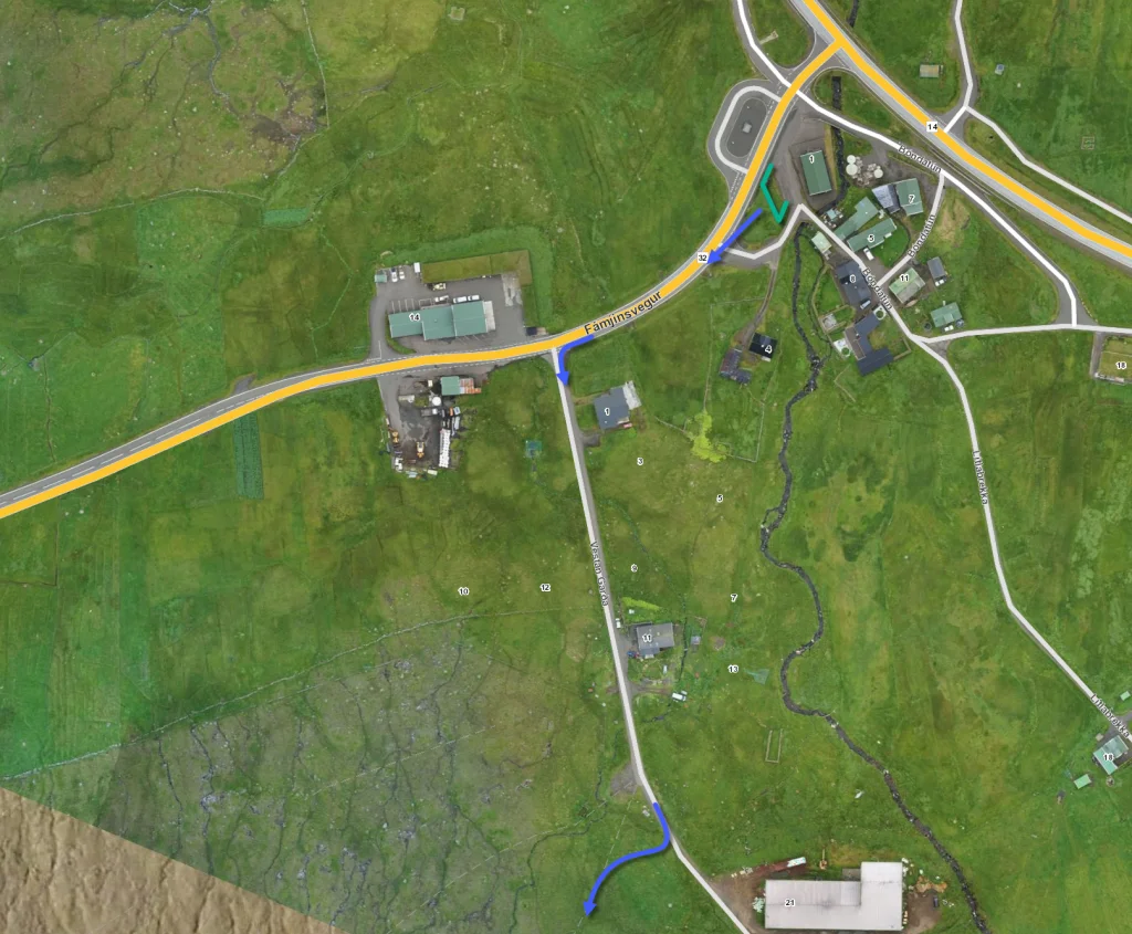 See green line for parking and blue line for starting point. The parking lot marked with green lines is just beside the adress Bóndatún 1, Ørðavík
 -
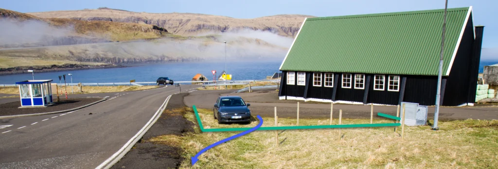 See green line for parking and blue line for starting point. The parking lot marked with green lines is just beside the adress Bóndatún 1, Ørðavík


Vágur - Øravík
Public transport:
Decent bus connection to Øravík with route 700
Parking, Vágur:
It is possible to park right outside the grove, where there is space for two cars, or to go further down where there is a parking area at the end of the road Geilin, right before the scout house (Geilin 103). Check the green line. From there, you have to walk through the grove, checking for blue signposts.
-
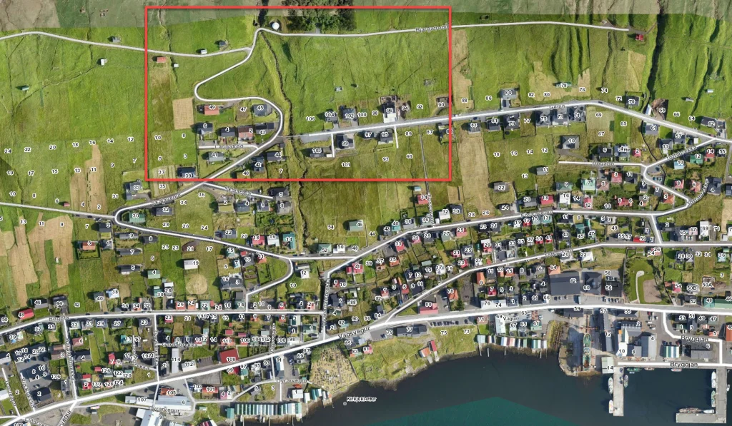 See next picture zooming in on the area just below the forrest where the route starts
 -
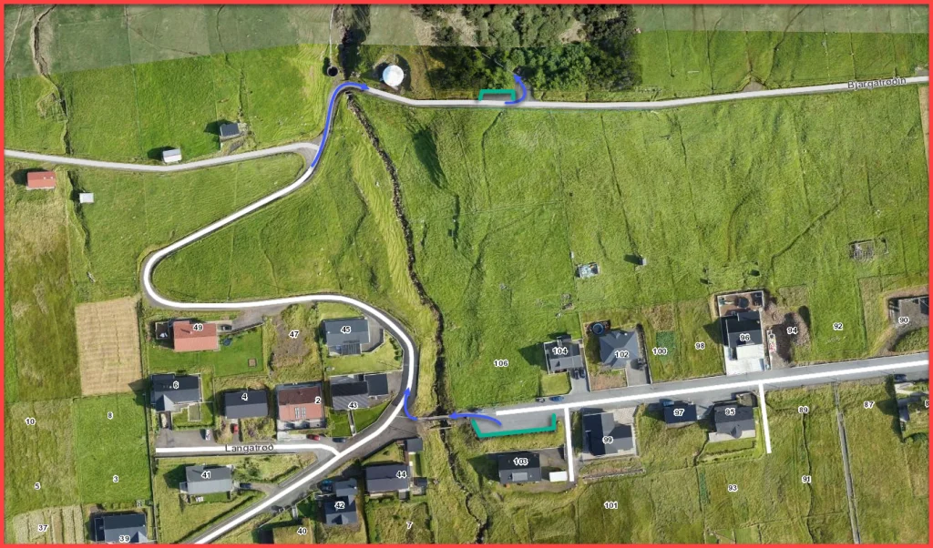 See green line for parking and blue line for starting point. The lower parking lot, marked with green lines, is at the address Geilin 103, Vágur
 -
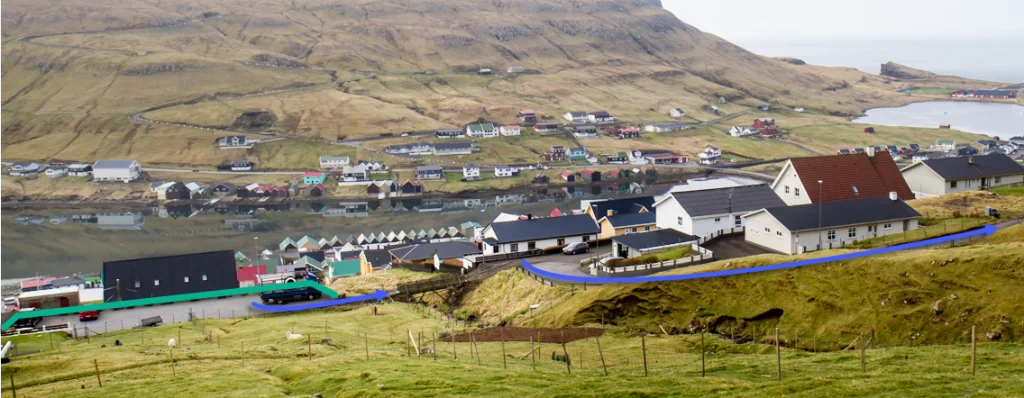 See green line for parking and blue line for starting point. The parking lot marked with green lines is at the adress Geilin 103, Vágur
 -
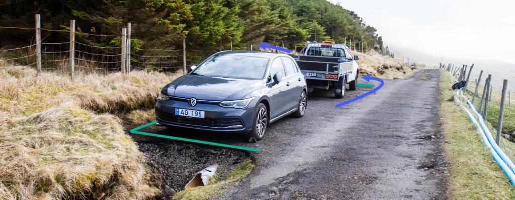 See green line for parking and blue line for starting point


Øravík - Vágur
Vágur - Øravík
Fakta

Tíð

longd

Hægsta stað

Hæddarmetrar
 The entire route is long and quite steep. Not recommended to kids younger than 10 years.
 Medium
- The slope in Hvannadal is a little steep; however, it is grassy and decent to walk on.
Medium
- The slope in Hvannadal is a little steep; however, it is grassy and decent to walk on.
 Decent grass terrain all the way. There is some loose material on the path north of Mannaskarð.
Terrain is wet in some areas. It is steep in Hvannadal, in the areas just above the grove in Vágur.
Decent grass terrain all the way. There is some loose material on the path north of Mannaskarð.
Terrain is wet in some areas. It is steep in Hvannadal, in the areas just above the grove in Vágur.

Øki / Torleikastig

 Avbjóðandi
 42 km /
16t
42 km /
16t

 2 km /
1t
2 km /
1t

 6 km /
2t
6 km /
2t


