


Tú hevur ongar yndis enn
Her kanst tú savna íblástur, greinar, tiltøk og støð, sum tú hevur áhuga fyri.
Trýst á ikonið á síðurnar, so koma tær fram her.
Tínir yndis
Íblástur & Greinir
Tiltøk & Túrar
Støð
Bygdagøtur
INSPIRATIÓNIR & ARTIKLAR
TILTØK & GONGUTÚRAR
Støð
Trongisvágur - Fámjin


Link Copied!

-
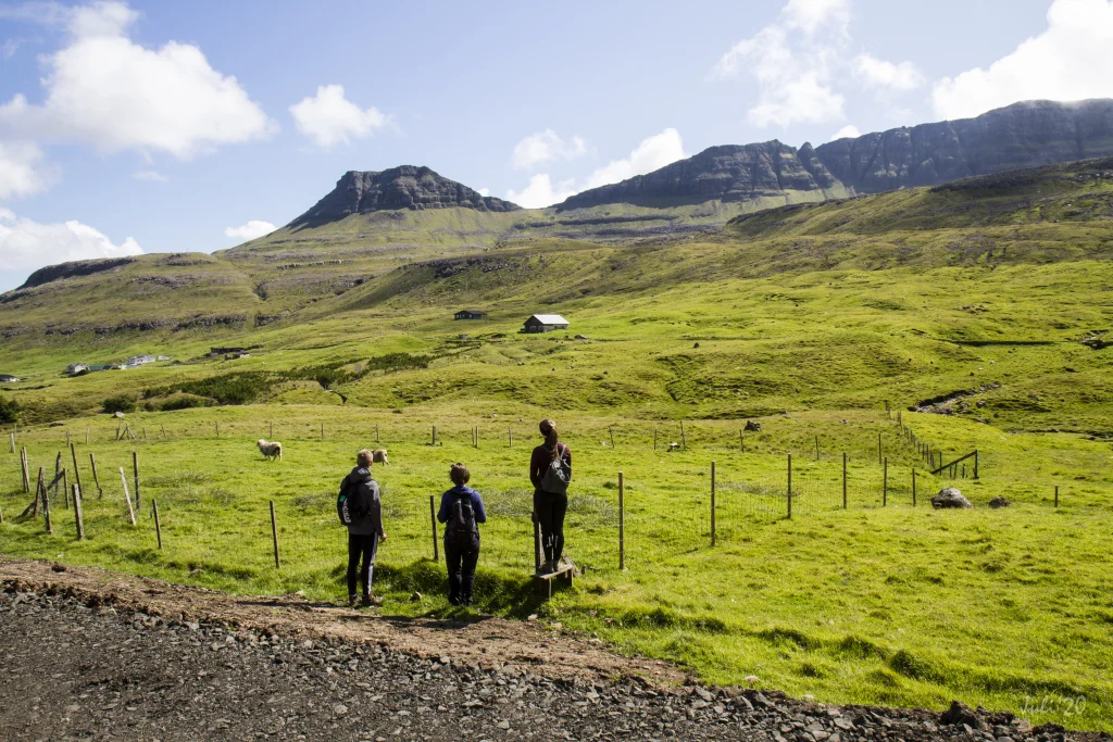 The village path starts in the place Mangibakki in the village Trongisvágur, and goes up to the pass Oyrnaskarð, which can be seen at the top in the middle of the picture. Photo: Óli Gardshodn
 -
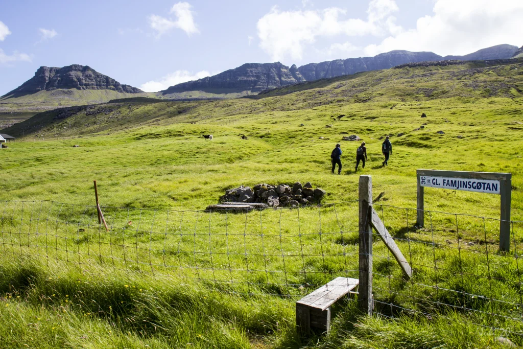 In the village of Trongisvágur there is good signage with cairns and signs. There are also steps at most fences, so it is easy to get across them. Photo: Óli Gardshodn
 -
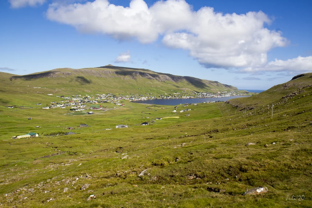 The view out through the fjord Trongisvágsfjørður, where you can see from the left to the right the villages Trongisvágur, Tvøroyri and Froðba. Photo: Óli Gardshodn
 -
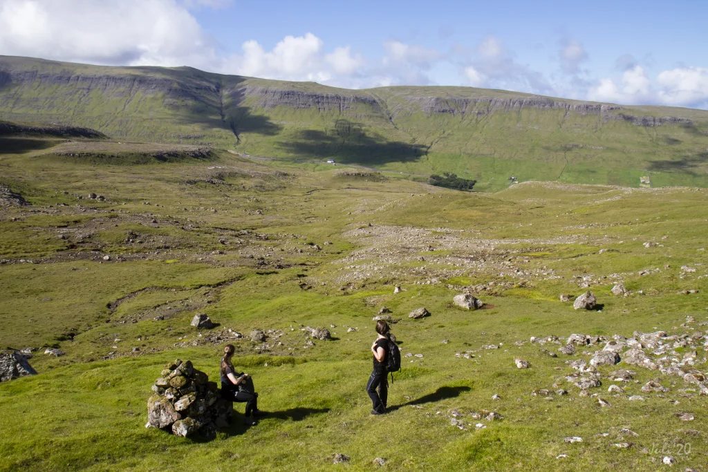 The view from the base of the mountain Oyrnafjall down to the starting point at the plantation in Trongisvági. Photo: Óli Gardshodn
 -
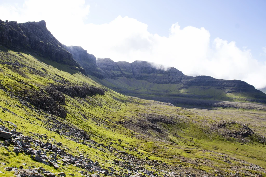 The view towards the cirque-shaped Hvammabotnur valley in Trongisvágur. In the middle of the picture is the island's highest mountain, Gluggarnir, 610m. Just to the left of Gluggarnir between the two deep gorges, is the so-called Herðablaðið - named after a shoulder blade, which it also looks like. Photo: Óli Gardshodn
 -
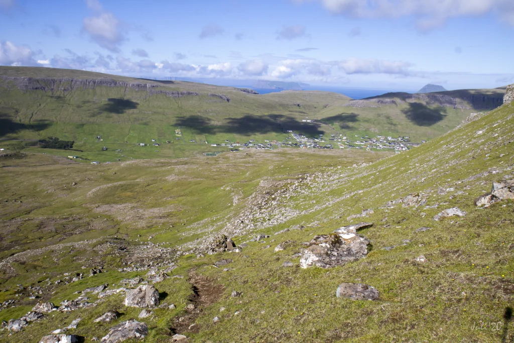 The view from the pass Oyrnaskarð in 346m. height, down towards the village of Trongisvágur. Photo: Óli Gardshodn
 -
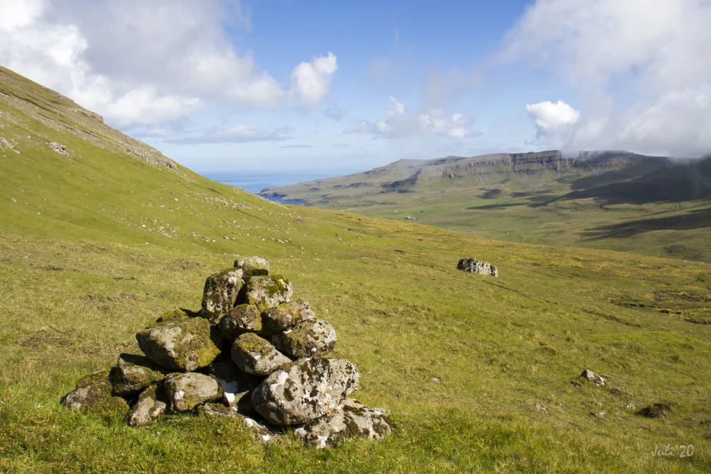 The view from the cairn up on the pass Oyrnaskarð in the direction of the village Øravík. Photo: Óli Gardshodn
 -
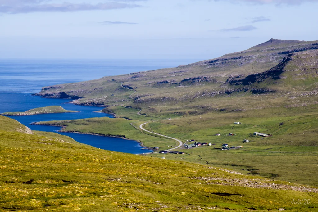 The view 200 m south of the pass Oyrnaskarð, down towards the village Øravík. In the background we can see the old road winding across the ridge, to the village of Hov. It has now been replaced by a tunnel. Photo: Óli Gardshodn
 -
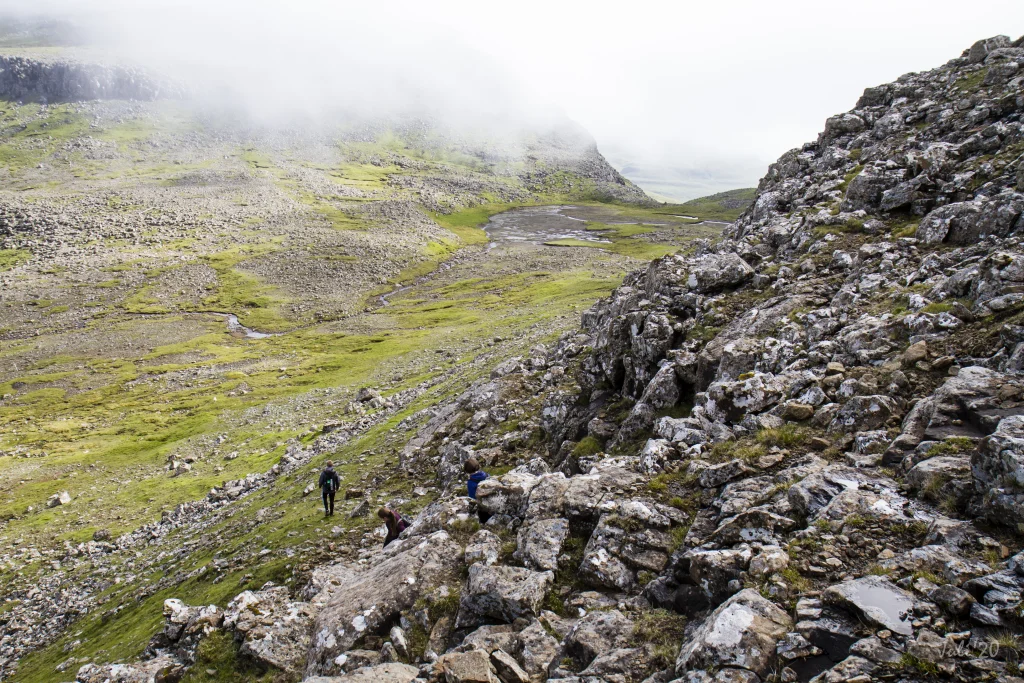 The view at the lower crag up by Harðgreipur down towards the pass Valdaskarð, which leads down to Kirkjuvatn in Fámjin. Photo: Óli Gardshodn
 -
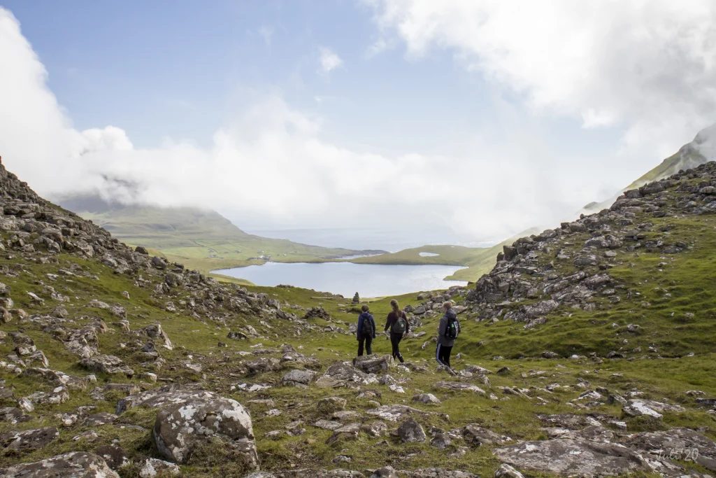 The village path through the Valdaskarð pass. In the background the lake Kirkjuvatn and the village Fámjin. Photo: Óli Gardshodn
 -
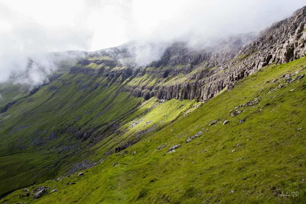 Column basalt in the crag north of Valdaskarð. Photo: Óli Gardshodn
 -
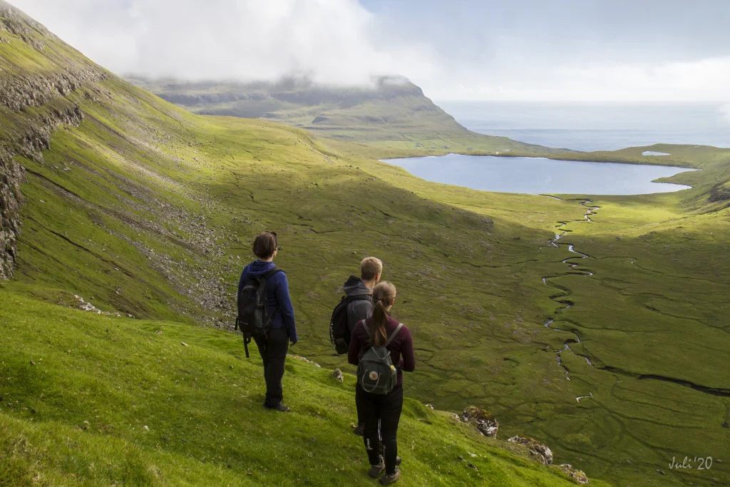 The beautiful view from the pass Valdaskarð, down towards the lake Kirkjuvatn. In the background the village of Fámjin. Photo: Óli Gardshodn
 -
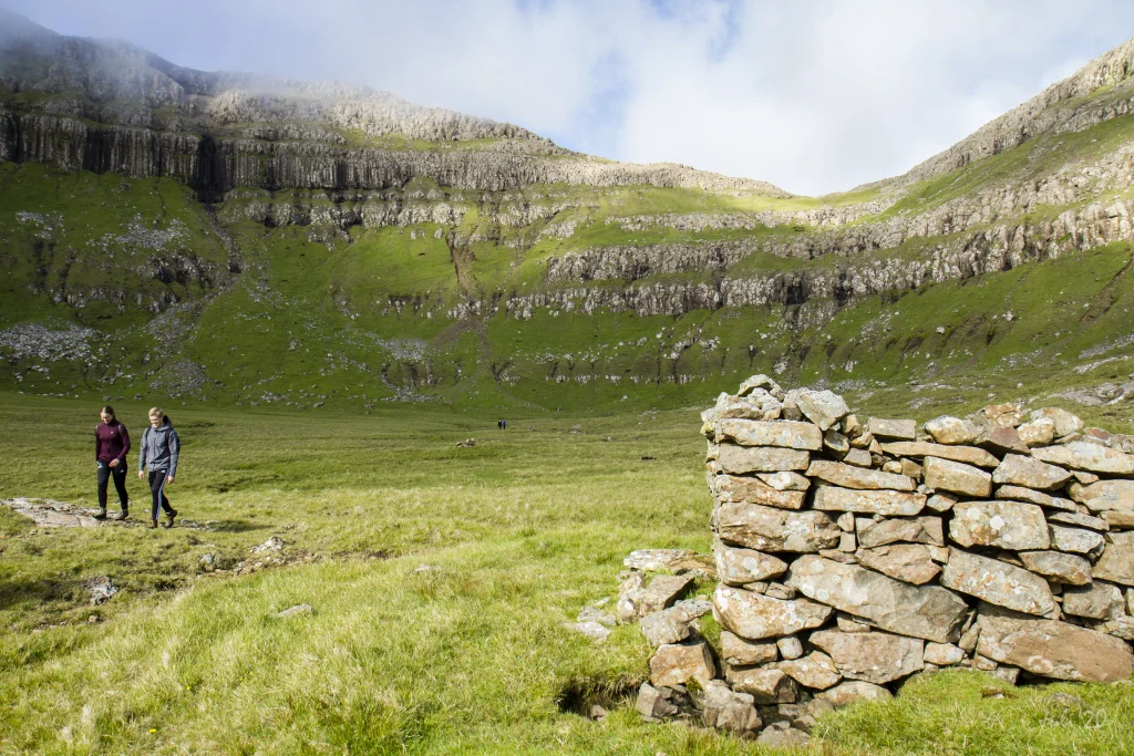 The path from the lake Kirkjuvatn up to the pass Valdaskarð. Photo: Óli Gardshodn
 -
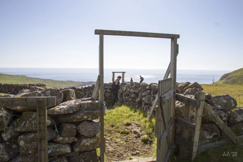 Through the sheepfold by the lake Kirkjuvatn up above the village Fámjin. Photo: Óli Gardshodn
 -
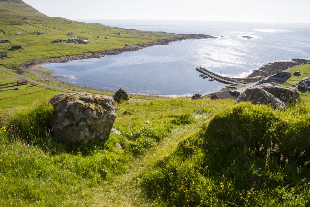 View from up above Fámjin. Photo: Óli Gardshodn


-
The village path starts in the place Mangibakki in the village Trongisvágur, and goes up to the pass Oyrnaskarð, which can be seen at the top in the middle of the picture. Photo: Óli Gardshodn
-
In the village of Trongisvágur there is good signage with cairns and signs. There are also steps at most fences, so it is easy to get across them. Photo: Óli Gardshodn
-
The view out through the fjord Trongisvágsfjørður, where you can see from the left to the right the villages Trongisvágur, Tvøroyri and Froðba. Photo: Óli Gardshodn
-
The view from the base of the mountain Oyrnafjall down to the starting point at the plantation in Trongisvági. Photo: Óli Gardshodn
-
The view towards the cirque-shaped Hvammabotnur valley in Trongisvágur. In the middle of the picture is the island's highest mountain, Gluggarnir, 610m. Just to the left of Gluggarnir between the two deep gorges, is the so-called Herðablaðið - named after a shoulder blade, which it also looks like. Photo: Óli Gardshodn
-
The view from the pass Oyrnaskarð in 346m. height, down towards the village of Trongisvágur. Photo: Óli Gardshodn
-
The view from the cairn up on the pass Oyrnaskarð in the direction of the village Øravík. Photo: Óli Gardshodn
-
The view 200 m south of the pass Oyrnaskarð, down towards the village Øravík. In the background we can see the old road winding across the ridge, to the village of Hov. It has now been replaced by a tunnel. Photo: Óli Gardshodn
-
The view at the lower crag up by Harðgreipur down towards the pass Valdaskarð, which leads down to Kirkjuvatn in Fámjin. Photo: Óli Gardshodn
-
The village path through the Valdaskarð pass. In the background the lake Kirkjuvatn and the village Fámjin. Photo: Óli Gardshodn
-
Column basalt in the crag north of Valdaskarð. Photo: Óli Gardshodn
-
The beautiful view from the pass Valdaskarð, down towards the lake Kirkjuvatn. In the background the village of Fámjin. Photo: Óli Gardshodn
-
The path from the lake Kirkjuvatn up to the pass Valdaskarð. Photo: Óli Gardshodn
-
Through the sheepfold by the lake Kirkjuvatn up above the village Fámjin. Photo: Óli Gardshodn
-
View from up above Fámjin. Photo: Óli Gardshodn
Ein lættur og sera vakur túrur um Oyrnaskarð og Valdaskarð, har nógv er at síggja á leiðini
Bygdagøtan byrjar beint oman fyri viðalundina í Trongisvági. Fyrst verður gingið tvørtur um Stórá og síðan niðaneftir í Hvammhaga. Her síggja vit niðan í sermerkta Hvammabotn við sínum jøvnu og stóru víddum, sum eru umgirdar av brøttum líðum, og innast í botninum er Herðablaðið við Herðablaðsgjáunum báðumegin við. Høgrumegin Herðablaðið eru Gluggarnir, sum við sínum 610m er hægsta fjall í Suðuroy. Á leiðini niðaneftir er gott útsýni oman yvir Trongisvág og leiðina yvir í Hvannhaga við lítlu og stóru Dímun í baksýninum.
Komin tvørtur um Oyrnaskarð er stutt yvir á Valdaskarð, har gingið verður oman gjøgnum Harðgreips hamrar. Meðan gingið verður, sæst suður í Øravíkshagan.
Tað er sera vakurt at ganga um Valdaskarð, meðan Kirkjuvatn og Fámjin daga meira og meira undan. Tá ið so gingið verður oman til Kirkjuvatn, síggjast flottu hamrarnir til báðar síður. Høgrumegin, kallað Undir Homrum, verður gingið tætt undir tí niðasta hamrinum, sum er rættiliga høgur hamari úr vøkrum stabbagróti.
Haðan verður gingið fram við Kirkjuvatni, og síðan sunnanvert ánna gjøgnum rættina oman til Fámjin.
Farleiðin er væl merkt við varðum allan vegin frá parkeringsplássinum í Trongisvági til Fámjin.
Til ber at ganga túrin báðumegin frá. Túrurin er eitt sindur lættari at ganga úr Trongisvági


Trongisvágur - Fámjin
Public transportation
Take Route 701 Fámjin – Tvøroyri – Sandvík. Most of the trips are so-called T-trips, i.e., you must notify SSL, the public transportation company, an hour in advance. For further information, see ssl.fo.
Parking, Trongisvágur
In Trongisvágur you can part by the side of the main road, 175 metres west of the woods – see the green line. From there cross the river and go up over the road í Lambabyrgi, where a sign labelled “Gl. Fámjinsgøtan” (The Old Fámjin Path) guides you up to the village path – see the blue lines.
-
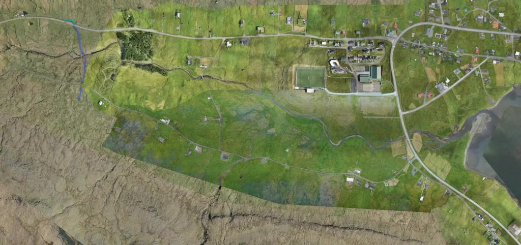 See green line for parking and blue line for starting point
 -
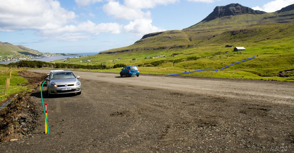 See green line for parking and blue line for starting point
 -
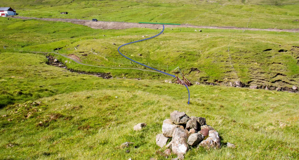 See green line for parking and blue line for starting point
 -
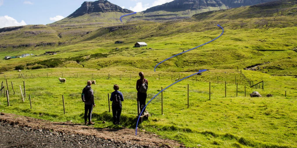 See blue line for starting point


Fámjin - Trongisvágur
Public Transport
Take Route 701 Fámjin – Tvøroyri – Sandvík. Most of the trips are so-called T-trips, i.e., you must notify SSL, the public transportation company, an hour in advance. For further information, see ssl.fo.
Parking, Fámjin
Good parking is found by the church in Fámjin, e.g., by the side of the road running down toward the shore (the pebble beach) – see the green line. From there, follow the blue line across the bridge and up through the sheep pen.
-
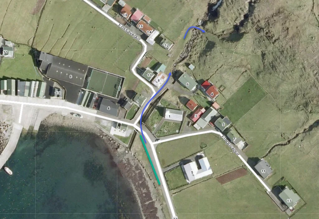 See green line for parking and blue line for starting point
 -
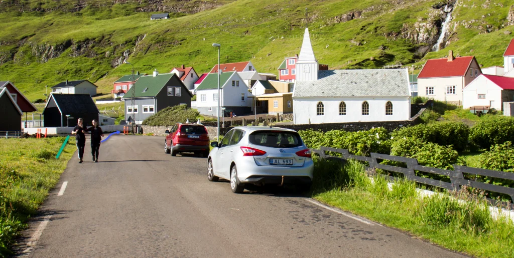 See green line for parking and blue line for starting point
 -
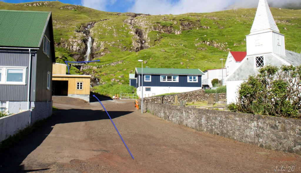 See blue line for starting point


Trongisvágur - Fámjin
Fámjin - Trongisvágur
Fakta

Tíð

longd

Hægsta stað

Hæddarmetrar
 Suitable for children over 8 years. Some of the hills are quite steep and the path passes through a few smaller crags. The hike is also somewhat long with significant elevation gain
 Medium
- Although it is quite steep from the pass Valdaskarð down to the lake Kirkjuvatn, the path is grass-covered and good for walking
Medium
- Although it is quite steep from the pass Valdaskarð down to the lake Kirkjuvatn, the path is grass-covered and good for walking
 Grass-covered and good for walking for the most part.
Some loose gravel on the path through the small crags of Harðgreipshamrar.
The descent down from Valdaskarð and down to Fámjin is quite steep
Grass-covered and good for walking for the most part.
Some loose gravel on the path through the small crags of Harðgreipshamrar.
The descent down from Valdaskarð and down to Fámjin is quite steep

Øki / Torleikastig

 Avbjóðandi
 42 km /
16t
42 km /
16t

 2 km /
1t
2 km /
1t

 6 km /
2t
6 km /
2t


