


Tú hevur ongar yndis enn
Her kanst tú savna íblástur, greinar, tiltøk og støð, sum tú hevur áhuga fyri.
Trýst á ikonið á síðurnar, so koma tær fram her.
Tínir yndis
Íblástur & Greinir
Tiltøk & Túrar
Støð
Bygdagøtur
INSPIRATIÓNIR & ARTIKLAR
TILTØK & GONGUTÚRAR
Støð
Hósvík - Leynavatn


Link Copied!

-
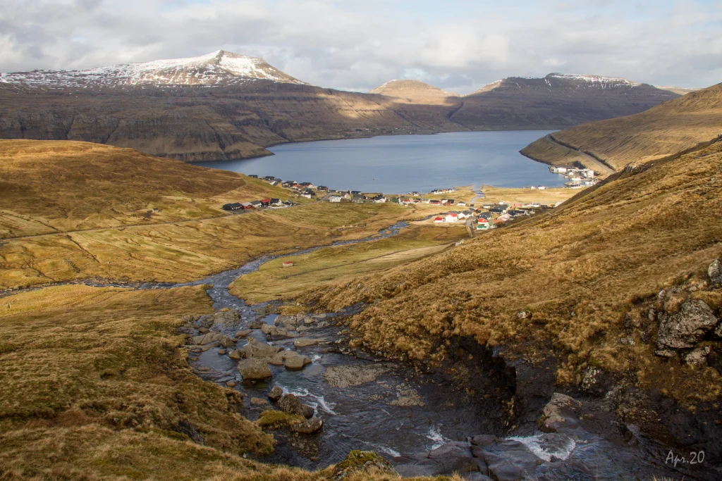 View from Tungubrekku above Hósvík. Photo: Óli Gardshodn
 -
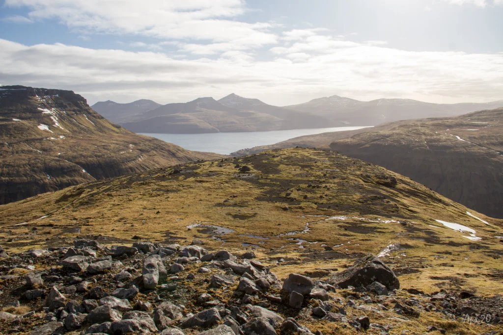 The view down over Á Hálsi by Leynavatn and over the strait Vestmannasund. In the background the island of Vágar. Photo: Óli Gardshodn
 -
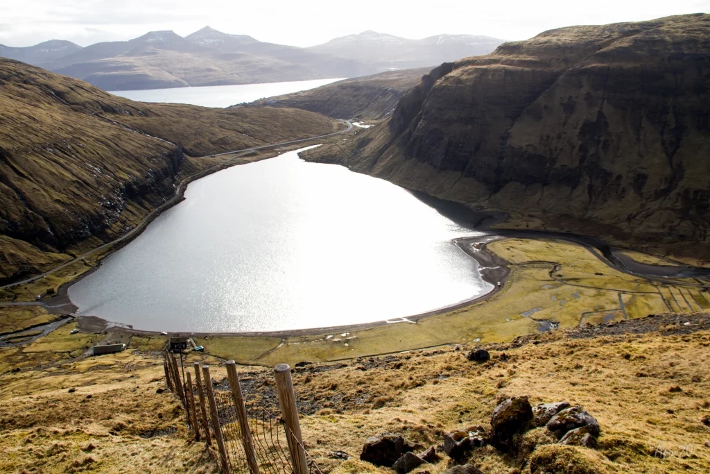 The view of Lake Leynavatn. Below you can just make out the village Stykkið. In the background, the Strait of Vestmannasund and the island of Vágar. Photo: Óli Gardshodn
 -
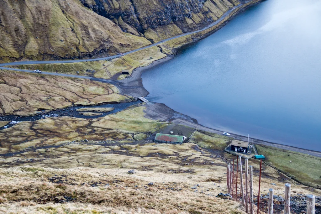 The first stretch up from the sheepfold by the water Leynavatn is fairly steep. Photo: Óli Gardshodn
 -
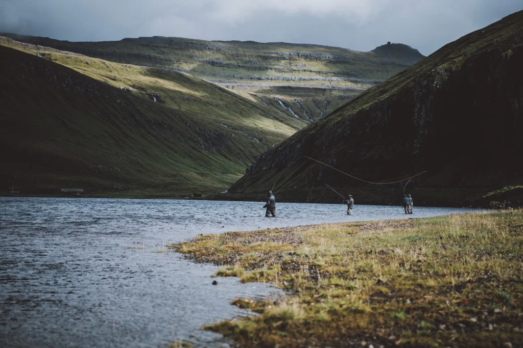 Lake Leynavatn. Photo:Jan Kellr - @jpkay
 -
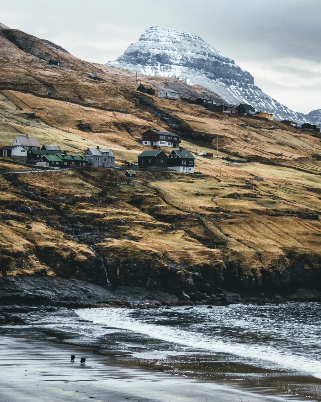 The village of Leynar. Photo: Pelle Faust - @pelle.faust


-
View from Tungubrekku above Hósvík. Photo: Óli Gardshodn
-
The view down over Á Hálsi by Leynavatn and over the strait Vestmannasund. In the background the island of Vágar. Photo: Óli Gardshodn
-
The view of Lake Leynavatn. Below you can just make out the village Stykkið. In the background, the Strait of Vestmannasund and the island of Vágar. Photo: Óli Gardshodn
-
The first stretch up from the sheepfold by the water Leynavatn is fairly steep. Photo: Óli Gardshodn
-
Lake Leynavatn. Photo:Jan Kellr - @jpkay
-
The village of Leynar. Photo: Pelle Faust - @pelle.faust
Ein spennandi og avbera vakur túrur, har dalur, gjógv og hugnaligt umhvørvið við Leynavatn seta sín serliga dám á túrin
Í Hósvík verður gingið niðan við tí mjáu og breiðu Lágá. Fleiri stórar áir møtast beint uttan fyri bøgarðin í hesa ánna. Við øllum hesum áum og tungum teirra millum, er sera hugnaligt og vakurt at ganga niðan. Tá ið gingið er niðan við Smørdalsá, verður komið í Smørdal. Uppi í Smørdali er friðsælt, bara heiðafuglur hoyrist og tutlið frá ánni, sum makliga rennur gjøgnum dalin. Hetta er sum at koma í aðra verð, og leivdirnar frá torvheiðunum minna um farnar tíðir.
Úr Smørdali verður gingið brøttu brekkuna niðan við tí stórfingnu Hósvíksgjógv og niðan á Lírahjalla. Hetta er allarhelst tyngsta og torførasta strekkið á leiðini. Men haðani er gott at ganga allan vegin niðan á Hósvíksskarð, millum Bøllufjall og Gívrufjall.
Oman móti Leynavatni er gott at ganga – eitt sindur bratt er seinasta strekkið oman ímóti vatninum.
Her verður gingið eftir einum ryggi millum tveir dalar, við vøkrum útsýni yvir Mjáuvøtn, Kollfjarðardal, Vestmannasund og Vágar, alt meðan harurnar renna um beinini á tær.
Tað er møguligt at ganga túrin úr báðum endum. Tað veldst um veður og ætt, hvør farleiðin er er tann betra.


Hósvík - Leynavatn
Public transport
Route 450 stops in Hósvík. And route 300 between Tórshavn and the airport as well as route 100 between Tórshavn and Vestmanna stop by the mouth of the tunnel in Leynar. This means you can park your car either in Hósvík or Leynar and return by bus.
Arriving by car
Parking, Hósvík
Good parking is found in Hósvík, where you can park either by the church or the school.
Two roads lead up to the gate in the village wall: 1) Up through the road Geilin, or 2) up Vøruvegur road, passing the school and then straight up above the football pitch, where you take a right by a small black hay barn, cross the new bridge over Lagá, where you meet
-
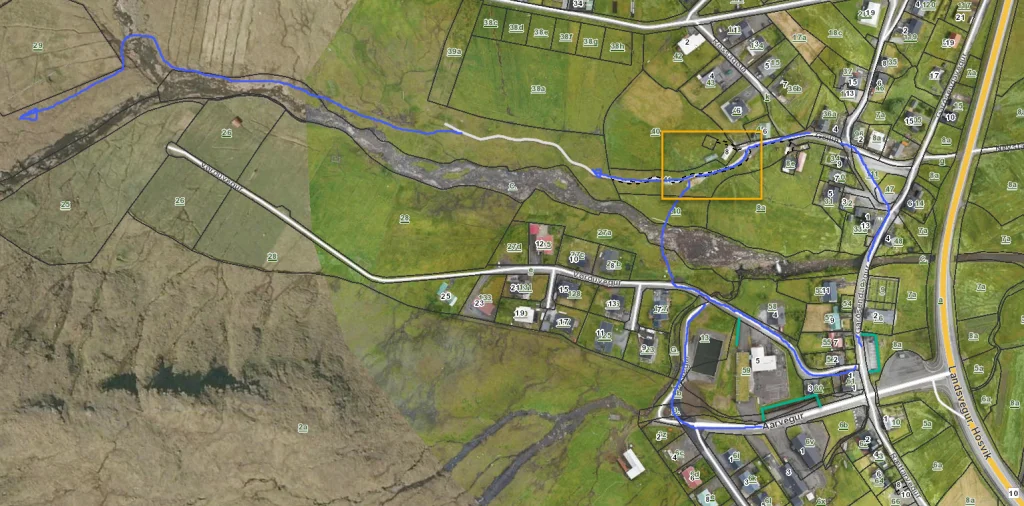 See green line for parking and blue line for starting point
 -
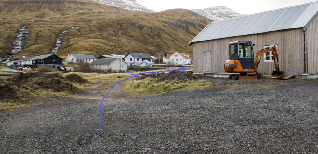 Follow blue line for getting your hike started


Leynavatn - Hósvík
Public transport
Route 450 stops in Hósvík. And route 300 between Tórshavn and the airport as well as route 100 between Tórshavn and Vestmanna stop by the mouth of the tunnel in Leynar. This means you can park your car either in Hósvík or Leynar and return by bus.
Arriving by car
Parking, Leynar
Good parking is found in Leynar, where you can park just north of the bridge that crosses the river Dalá. Park by the green line (see photo) and follow the blue line through the gate.
-
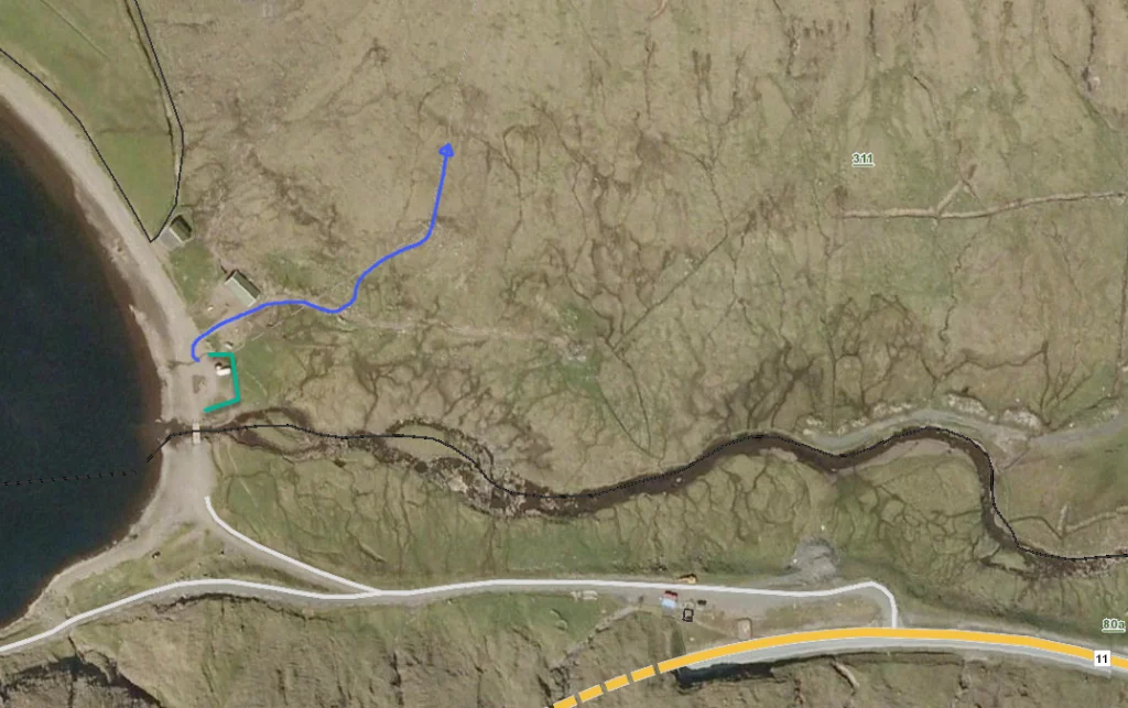 See green line for parking and blue line for starting point
 -
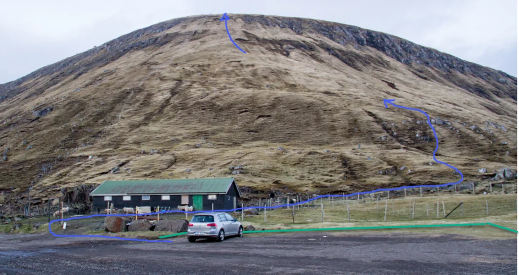 See green line for parking and blue line for starting point


Hósvík - Leynavatn
Leynavatn - Hósvík
Fakta

Tíð

longd

Hægsta stað

Hæddarmetrar
 Children should be not less than 10 years old
 Difficult
- The path is grass-covered and easy to walk, except along Hósvíksgjógv, on the path up through the crag above Uppi á Hálsi, and the hill above Leynavatn. Some might also find the stretch across the river above Hósvíksgjógv and up to Lírahjalli vertiginous
Difficult
- The path is grass-covered and easy to walk, except along Hósvíksgjógv, on the path up through the crag above Uppi á Hálsi, and the hill above Leynavatn. Some might also find the stretch across the river above Hósvíksgjógv and up to Lírahjalli vertiginous
 Grass-covered and good for walking throughout. Steep at times, especially when passing Hósvíksgjógv and up toward Lírahjalli as well as above Leynavatn. Smørdalur is wet in places. One most climb over a fence at uppi undir Hálsi, above Leynavatn



Øki / Torleikastig

 Avbjóðandi
 8 km /
2t
30m
8 km /
2t
30m


 16 km /
5t
30m
16 km /
5t
30m


