


Tú hevur ongar yndis enn
Her kanst tú savna íblástur, greinar, tiltøk og støð, sum tú hevur áhuga fyri.
Trýst á ikonið á síðurnar, so koma tær fram her.
Tínir yndis
Íblástur & Greinir
Tiltøk & Túrar
Støð
Bygdagøtur
INSPIRATIÓNIR & ARTIKLAR
TILTØK & GONGUTÚRAR
Støð
Leynar - Kollafjørður


Link Copied!

-
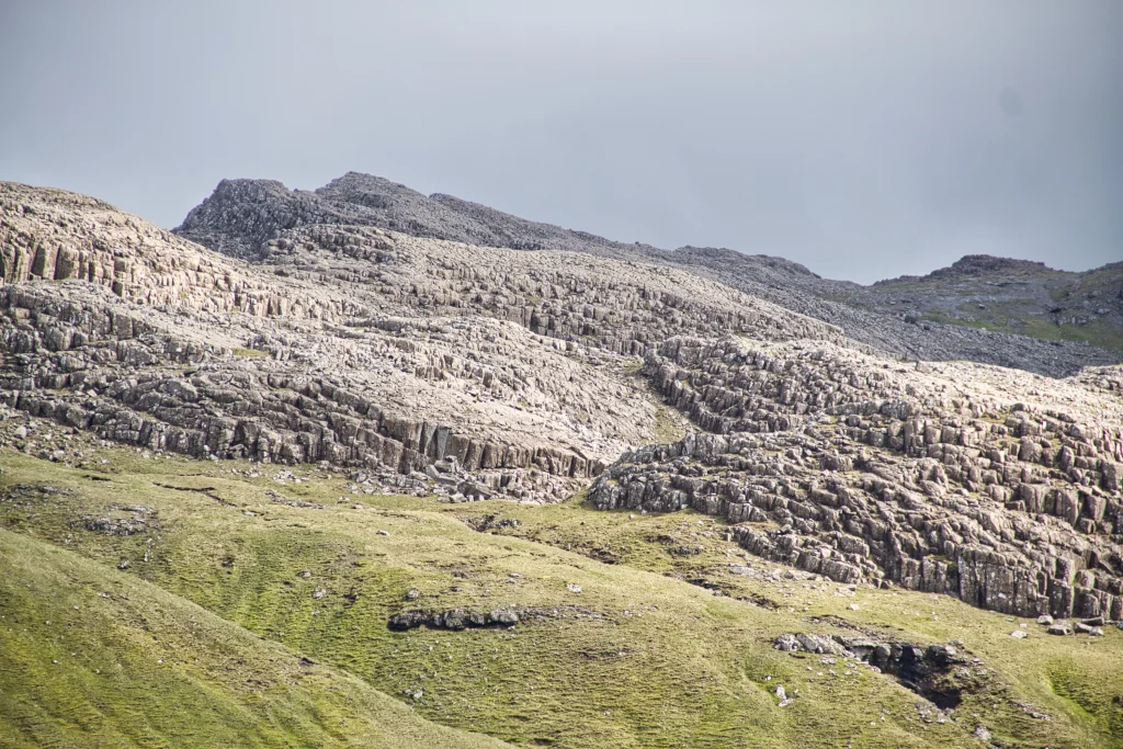 The special columnar basalt Stórareyn, north of the mountain Skælingsfjall. This is part of the well-known sill Streymoyarsyllin. Photo: Óli Gardshodn
 -
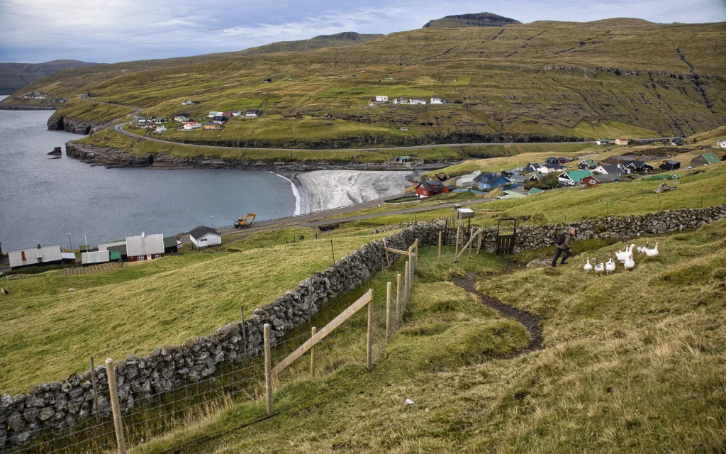 View above the village gate down towards the village of Leynar. Photo: Óli Gardshodn
 -
 On the way up from the village of Leynar, you walk closely along the gorge Kollfjarðargjógv and the waterworks located just below the gorge. Photo: Óli Gardshodn
 -
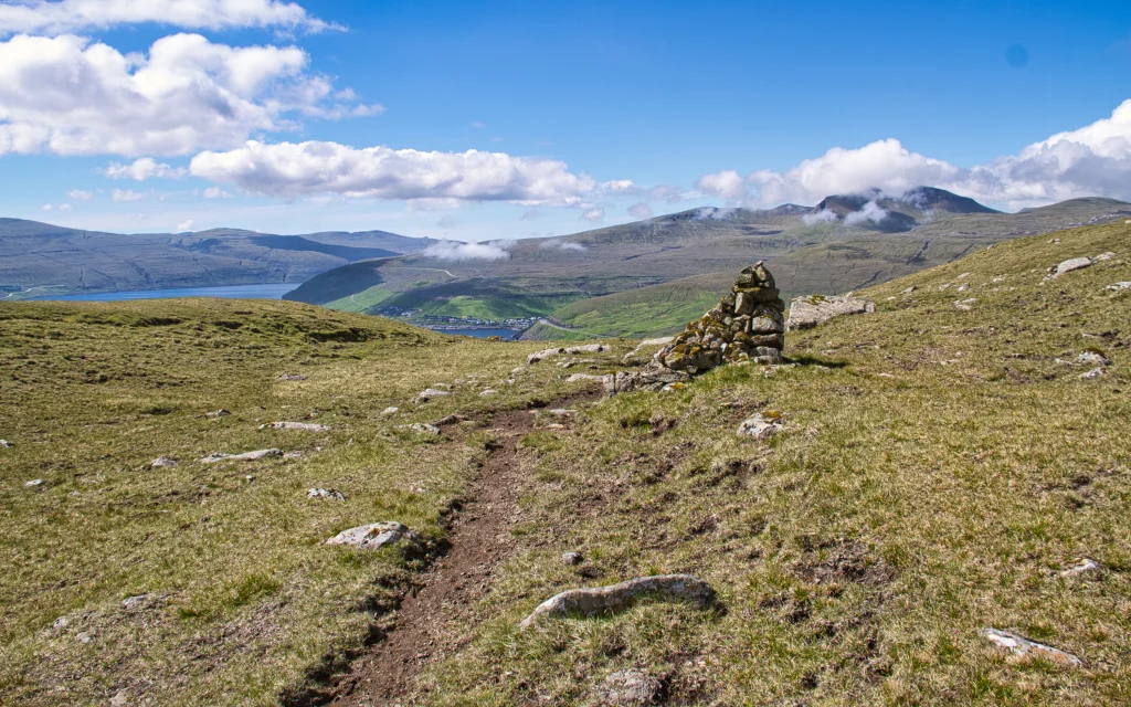 Above Setberg, at an altitude of 250 m, the view is very good. Here we see the village of Kvívík and to the right the mountain Egilsfjall, 618 m. Photo: Óli Gardshodn
 -
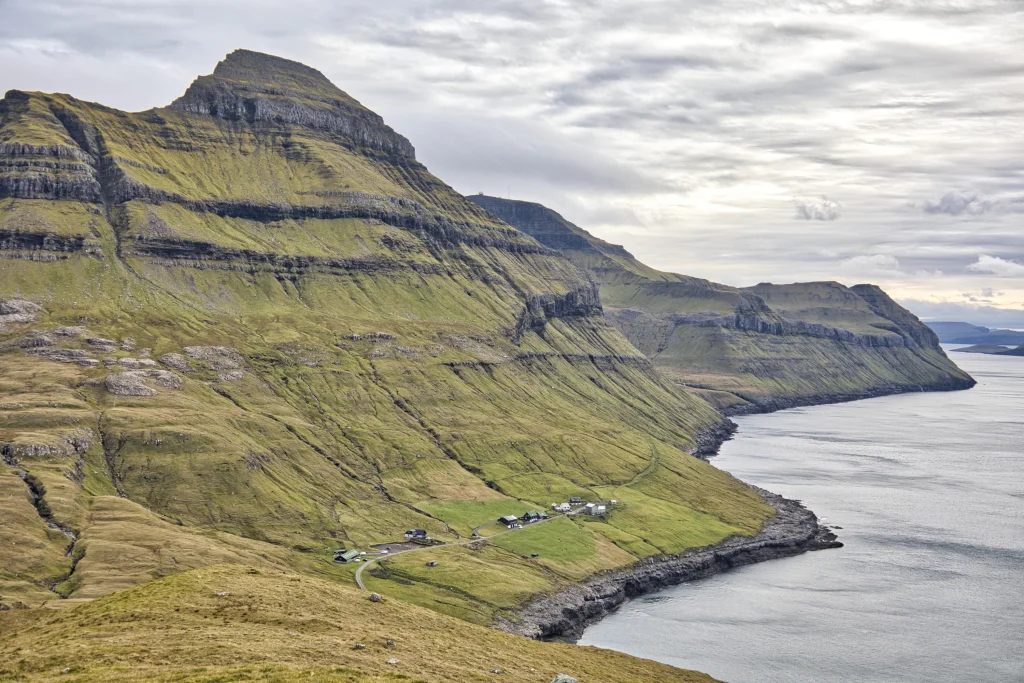 View above Setberg south towards the west side of the island of Streymoy, where we see the settlement Skælingur, the mountain Skælingsfjall, 767 m. Further south the valleys Gjáarbotnur and Skorardalur. In the background on the far right, the islands of Koltur and Sandoy can be seen. Photo: Óli Gardshodn
 -
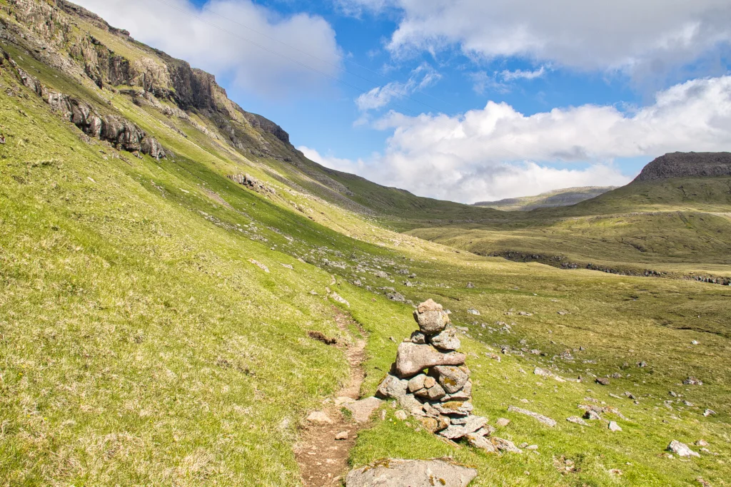 The view below the rock wall Hjallabrúgvin east towards Hóvabrekka and the wide pass that we cross. To the right the gorge Marknagil and above columnar basalt at Regnsendin. Photo: Óli Gardshodn
 -
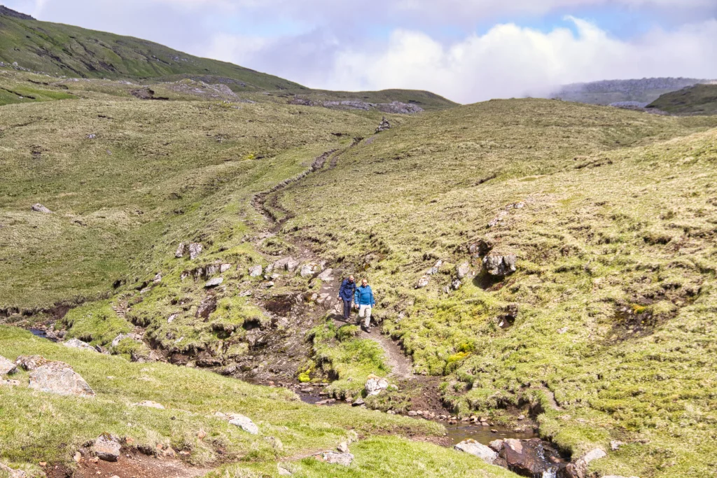 The path across the stream above the gorge Marknagil. Photo: Óli Gardshodn
 -
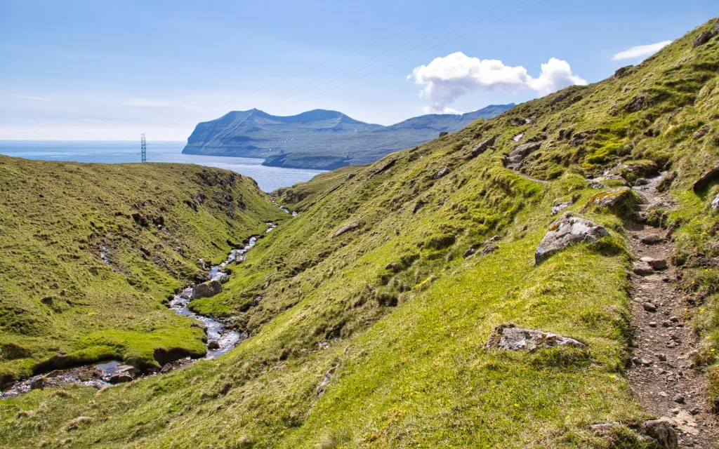 The view down the gorge Marknagil. Photo: Óli Gardshodn
 -
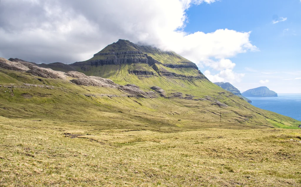 The view south towards the mountain Skælingsfjall, 767 m. In the middle across the picture, you can see the special columnar basalt on Stórareyn. This is part of the well-known Streymoyarsyllin, a sill which is a so-called irregular intrusive formation that undulates between the basalt stratums. The geologists love this place. Photo: Óli Gardshodn
 -
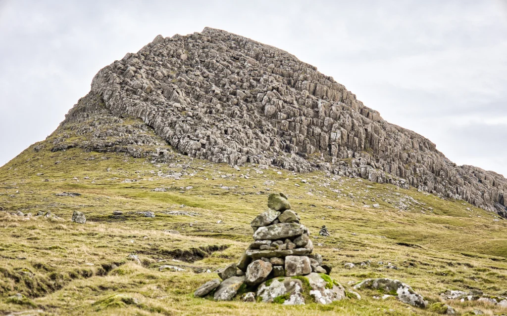 The path along the special columnar basalt on Regnsenden. Photo: Óli Gardshodn
 -
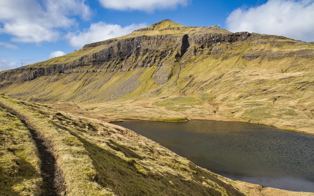 The pond Tjørnin á Brekkunum. Photo: Óli Gardshodn


-
The special columnar basalt Stórareyn, north of the mountain Skælingsfjall. This is part of the well-known sill Streymoyarsyllin. Photo: Óli Gardshodn
-
View above the village gate down towards the village of Leynar. Photo: Óli Gardshodn
-
On the way up from the village of Leynar, you walk closely along the gorge Kollfjarðargjógv and the waterworks located just below the gorge. Photo: Óli Gardshodn
-
Above Setberg, at an altitude of 250 m, the view is very good. Here we see the village of Kvívík and to the right the mountain Egilsfjall, 618 m. Photo: Óli Gardshodn
-
View above Setberg south towards the west side of the island of Streymoy, where we see the settlement Skælingur, the mountain Skælingsfjall, 767 m. Further south the valleys Gjáarbotnur and Skorardalur. In the background on the far right, the islands of Koltur and Sandoy can be seen. Photo: Óli Gardshodn
-
The view below the rock wall Hjallabrúgvin east towards Hóvabrekka and the wide pass that we cross. To the right the gorge Marknagil and above columnar basalt at Regnsendin. Photo: Óli Gardshodn
-
The path across the stream above the gorge Marknagil. Photo: Óli Gardshodn
-
The view down the gorge Marknagil. Photo: Óli Gardshodn
-
The view south towards the mountain Skælingsfjall, 767 m. In the middle across the picture, you can see the special columnar basalt on Stórareyn. This is part of the well-known Streymoyarsyllin, a sill which is a so-called irregular intrusive formation that undulates between the basalt stratums. The geologists love this place. Photo: Óli Gardshodn
-
The path along the special columnar basalt on Regnsenden. Photo: Óli Gardshodn
-
The pond Tjørnin á Brekkunum. Photo: Óli Gardshodn
Landslagið er fjølbroytt og Stabbagrótið á Stórareyni skarar framúr á leiðin
Serliga vakurt er at ganga ímóti Leynum, og hetta er eisini ein munandi lættari túrur, av tí at byrjað verður so høgt uppi. Gøtan er nógv gingin, eisini við rossum, og tað sæst væl við nógvu rossasporunum á leiðini. Friðsælt og vakurt er inni í dalinum, tvørtur um Marknagil og víðari niðan, har tú sært niðan í Líraberg og stabbagrótið á Stórareyni. Tað er ikki so væl uppmerkt, har bygdagøturnar byrja í hvør sínum enda, men annars eru nógvir varðar, ið eisini eru í góðum standi. Av tí at gøtan er so mikið nógv traðkað, sæst hon væl allan vegin, tó ikki seinastu metrarnar oman á Oyggjarvegin. Portur eru at ganga um í Leynum. Tað er vakrari og lættari at ganga ímóti Leynum.


Leynar - Kollafjørður
Public transport
Bus Route 100/300 stops in Leynar
Arriving by car
Parking, Leynar
Parking is available along the main road close to where the path starts (see photo).

Kollafjørður – Leynar
Public transport
By bus you can take route 100/300 between Tórshavn and Vestmanna which stops in Kollafjørður.
You can also take route 450 between Skálafjørður og Kollafjørð
Arriving by car
Parking, Kollafjørður
There is a large parking area by Búnaðarstovan (Agency for Agriculture and Aquaculture) in Kallafjørður. See photo below
Leynar - Kollafjørður
Kollafjørður – Leynar
Fakta

Tíð

longd

Hægsta stað

Hæddarmetrar
 This hike is suitable for children
 Medium
- A mostly visible, grass-covered trail that is relatively easy to hike but fairly long
Medium
- A mostly visible, grass-covered trail that is relatively easy to hike but fairly long
 Grass-covered throughout with deep hoof prints, especially as you draw close to Leynar, where the path looks worn



Øki / Torleikastig

 Avbjóðandi
 8 km /
2t
30m
8 km /
2t
30m


 16 km /
5t
30m
16 km /
5t
30m


