


Tú hevur ongar yndis enn
Her kanst tú savna íblástur, greinar, tiltøk og støð, sum tú hevur áhuga fyri.
Trýst á ikonið á síðurnar, so koma tær fram her.
Tínir yndis
Íblástur & Greinir
Tiltøk & Túrar
Støð
Bygdagøtur
INSPIRATIÓNIR & ARTIKLAR
TILTØK & GONGUTÚRAR
Støð
Leynavatn - Vestmanna


Link Copied!

-
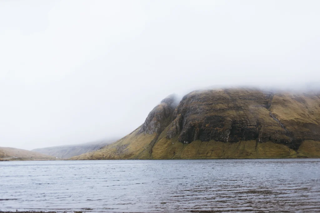 The hike starts by Leynavatn. Photo: Ingrid Hofstra
 -
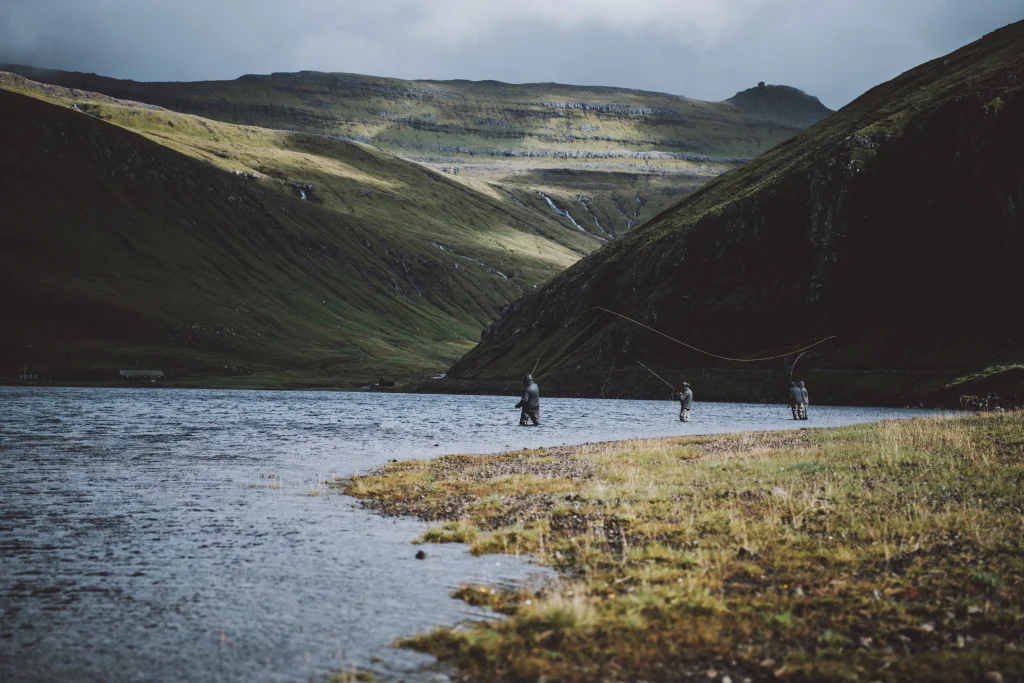 Fly fishing is popular on Leynavatn in the Faroe Islands. Photo: Jan Kellr
 -
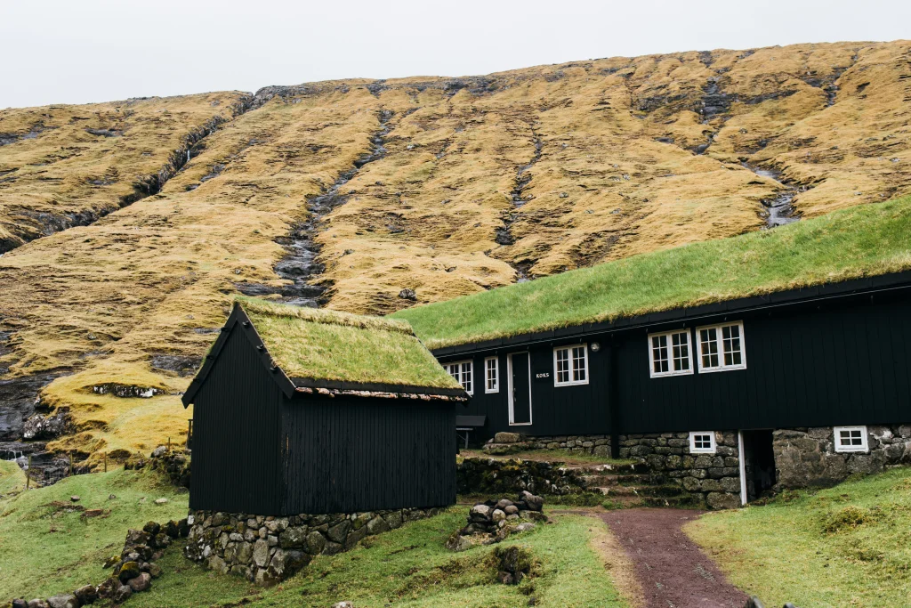 Michelin Star Restauran Koks is situated by Leynavatn. Photo by: Ingrid Hofstra
 -
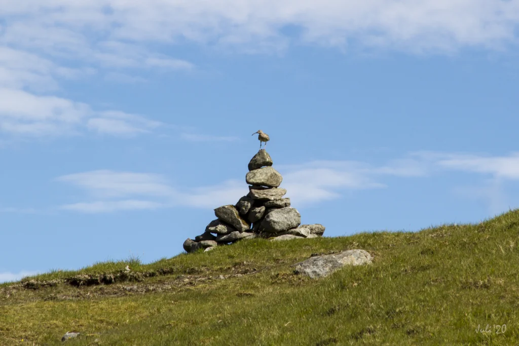 Cairn on the villagepath between Leynavatn and Vestmanna. Photo: Óli Garðshorn
 -
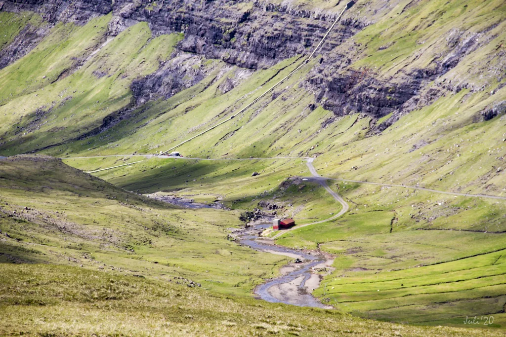 Approaching Vestmanna you will cross a wide river and continue along the river down to a road leading into Vestmanna. Photo: Óli Garðshorn


-
The hike starts by Leynavatn. Photo: Ingrid Hofstra
-
Fly fishing is popular on Leynavatn in the Faroe Islands. Photo: Jan Kellr
-
Michelin Star Restauran Koks is situated by Leynavatn. Photo by: Ingrid Hofstra
-
Cairn on the villagepath between Leynavatn and Vestmanna. Photo: Óli Garðshorn
-
Approaching Vestmanna you will cross a wide river and continue along the river down to a road leading into Vestmanna. Photo: Óli Garðshorn
Í vakra umhvørvinum frammi við Gjónna við Leynavatn, har sum Michelin matstovan KOKS heldur til, verður gingið niðan við Ærgisá og yvir í tann djúpa og langa Heygadal
Túrurin byrjar við Leynavatn, har koyrt kann verða inn gjøgnum Drangaósa og víðari inn gjøgnum Oyrarnar, so langt sum til ber, uttan at fara tvørtur um nakra djúpa á. Bilurin kann so setast á eini sandoyru, haðan farið verður til gongu inn í dalin, fram við Dalá. Komin nakað inn um Koks matstovuna við Gjónna verður gingið eftir løgasteinunum yvir um ánna. Haðan skrátt niðan undir Navurtunguna, har farið verður tvørtur um ta breiðu og vøkru Ærgisá. Við vakra útsýninum yvir dalin verður síðan gingið niðan við ánni, yvir um Gotursháls og oman í Heygadal.
Komin niðan á fyrstu høvdina sæst fyrsti varðin. Haðan standa teir tætt allan vegin oman til ánna í Heygadali. Uppiá eru varðarnir tættir og stórir, so tað er lætt at finna vegin. Men á sjálvum Goturshálsi krossar hendan bygdagøtan eina aðra bygdagøtu, nevniliga ta millum Kvívík og Hvalvík. Her skal ansast eftir ikki at fara skeivur av varðunum.
Uppi á Goturshálsi verður gingið gjøgnum Ognarhagan, sum er størsti hagi í Føroyum við 500 áseyðum. Hetta er eisini størsti matrikul í Føroyum, nevniliga umleið 15 km2.
Í Vestmanna verður gingið oman í Heygadal gjøgnum Tvørbrekkuna. Har verður farið tvørtur um breiðu ánna og haðan fram við ánni oman á vegin, sum gongur oman til Vestmanna. Hendan áin setur sín vakra dám á dalin.
Tað er lætt at ganga tvørtur um stóru áirnar á hásumri. Munandi torførari er tað hinar árstíðirnar, har tað ikki altíð ber til.


Leynavatn - Vestmanna
Buses stop both in Leynar and in Vestmanna. See SSL routes 100/300
Both places are easiest to reach by car.
Arriving by car
Parking, Leynavatn
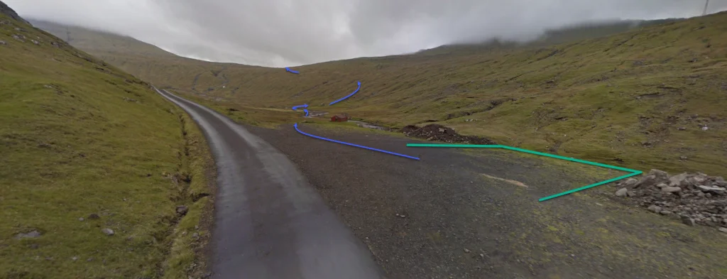
By Leynavatn you can drive quite far into the valley without having to cross any rivers (see the blue lines), where you can park on a sandy spit. From there, walk into the valley to reach path, which commences a little past where Restaurant KOKS is located.
-
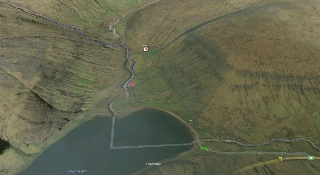 Follow the blue line for starting point. See green line for parking
 -
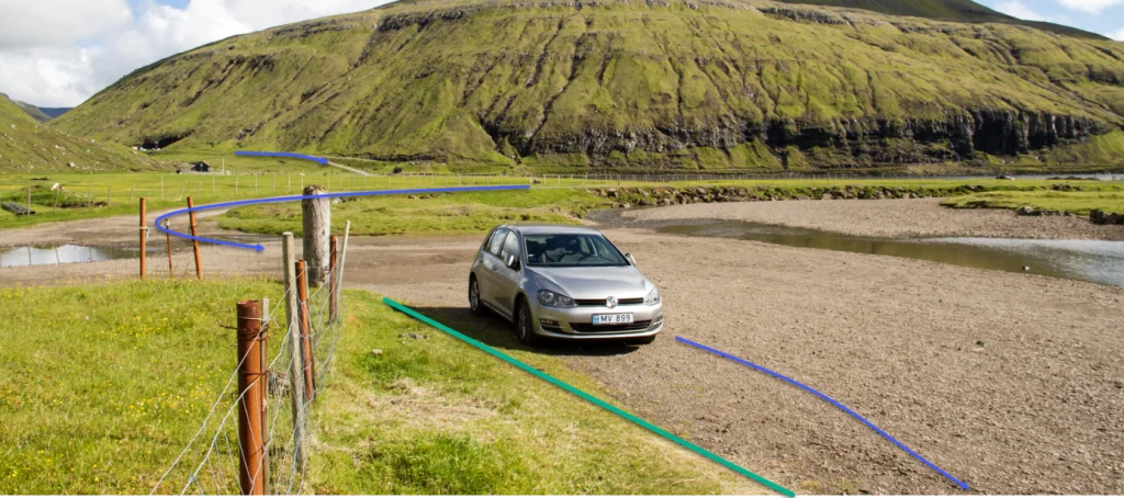 Parking Leynavatn. See green line for parking and blue line for starting point


Vestmanna - Leynar
Public transport
Buses stop both in Leynar and in Vestmanna. See SSL routes 100/300
Both places are easy to reach by car.
Arriving by car
Parking, Vestmanna
In Vestmanna, drive up the road Leitisvegur and park your car just above the dam in Heygadalur (see the green lines on the photo). From there, follow the blue line upward.
-
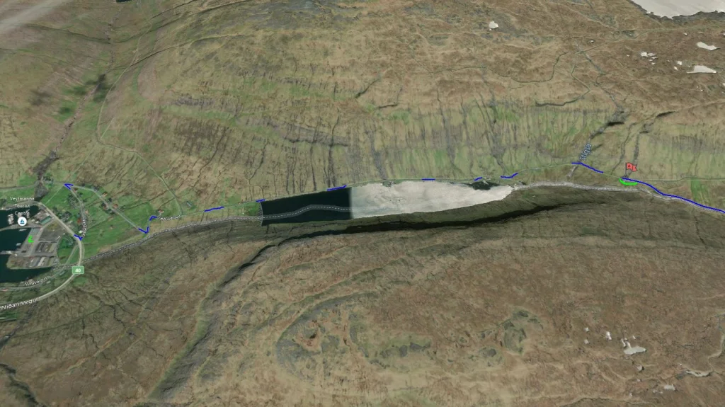 See green line for parking and blue line for starting point
 -
 Parking in Vestmanna. See green line for parking and blue line for starting point


Leynavatn - Vestmanna
Vestmanna - Leynavatn
Fakta

Tíð

longd

Hægsta stað

Hæddarmetrar
 Suitable for children over 10 years. If children are carried across the river, the hike is suitable for children 6-year-old and older. The path is good for walking, although quite long
 Difficult
- Two rivers must be forded. The water is at times high in the rivers, making them difficult to ford. No large steppingstones have been placed in this river, but there are enough rocks in it, which makes it crossable when it is dry in summertime.
If the water is high in Dalá, walk another 400 metres up the riverbank on its eastern bank until you reach the sheep shed at Ærgisáfløta, where you usually can cross the river close by the sheep pen
Difficult
- Two rivers must be forded. The water is at times high in the rivers, making them difficult to ford. No large steppingstones have been placed in this river, but there are enough rocks in it, which makes it crossable when it is dry in summertime.
If the water is high in Dalá, walk another 400 metres up the riverbank on its eastern bank until you reach the sheep shed at Ærgisáfløta, where you usually can cross the river close by the sheep pen
 Grass-covered and good for walking throughout. In places, it is quite wet, especially when crossing the pass Goturshálsur. Two rivers must be forded. When the waters are low, one can cross over steppingstones

Øki / Torleikastig

 Avbjóðandi
 8 km /
2t
30m
8 km /
2t
30m


 16 km /
5t
30m
16 km /
5t
30m


